This Quarter at Trebek
Issue #8
| June, 2026
TREBEK READS
THE FOREST
Forests are constantly changing. Fire, climate, wildlife, and people all leave their mark on the landscape. In this issue, we follow researchers, photographers, and Indigenous knowledge holders who are helping us understand what these changes mean for the future of Canada's forests.
IN THIS ISSUE
TREBEK READS THE FOREST: Annie Sakkab explores what is lost when ancient forests are transformed into everyday consumer products. Dalal Hanna examines how logging reshapes freshwater systems over time. Dorian Gaboriau reconstructs long-term forest and fire histories to understand how these systems have changed across regions.
IMPACT BEYOND THE TREBEK GRANT: Building on years of documenting endangered old-growth forests, 2021 Trebek Grantee TJ Watt is now helping advance conservation finance initiatives that support newly protected areas and Indigenous-led management to prevent the loss of critical old-growth forests.
2026 PROJECTS ANNOUNCED: Meet our newest 6 Trebek Grantees. This year's work includes Indigenous stewardship in the Muskwa-Kechika, earthquake and tsunami hazards along the Pacific coast, killer whale communication, how Canada's northern forests are responding to a warming climate, human-polar bear coexistence in Newfoundland and Labrador, and a photographic journey along the St. Lawrence River.
FEATURED PROJECT: 2024 Trebek Grantee Ellen Whitman studied how wildfire and climate are reshaping forest recovery across western Canada, identifying where regeneration is less likely and informing forest management.
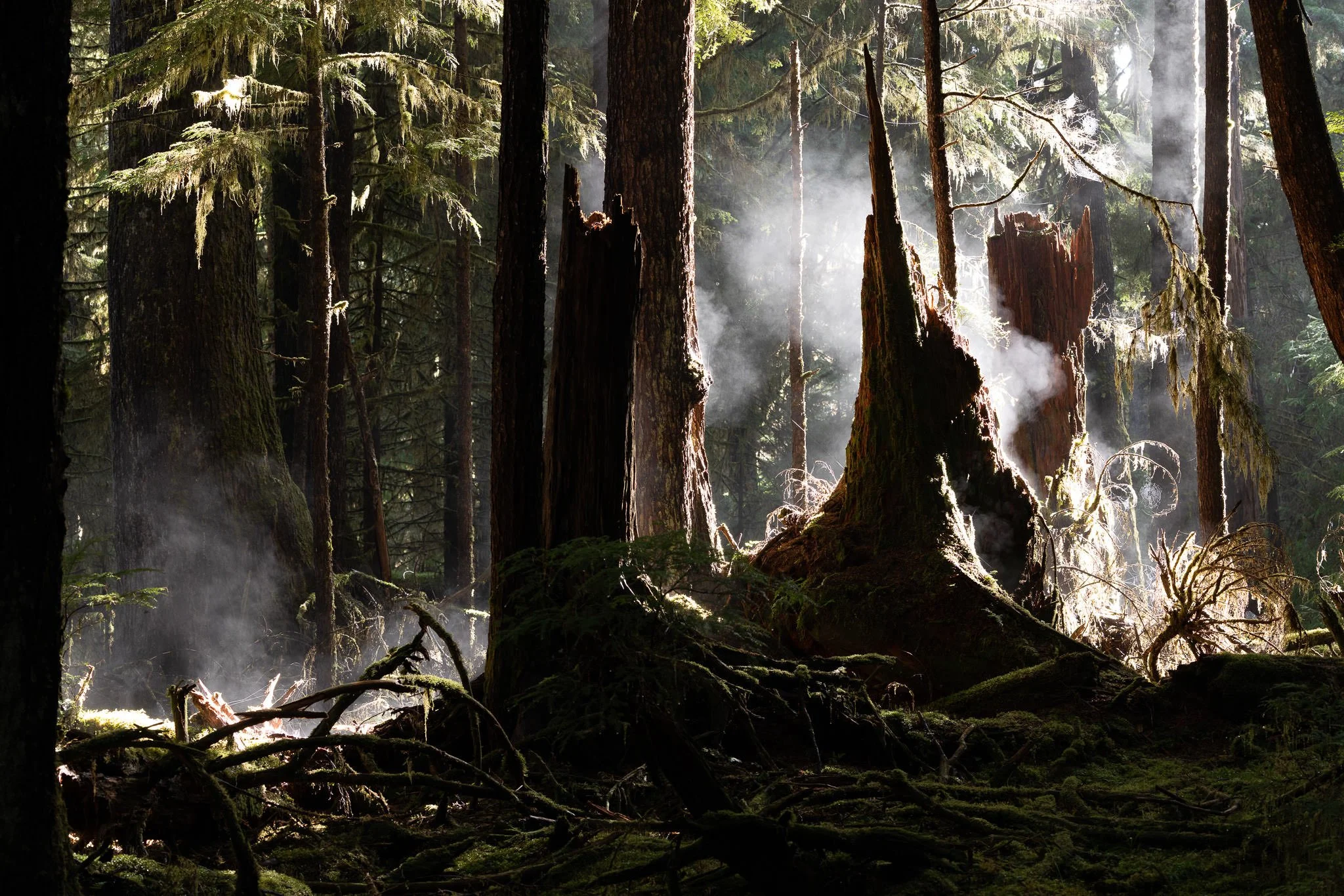
Photo Credit: TJ Watt .
TREBEK READS
THE FOREST
How changing forests are reshaping land and water over time
Forests across Canada are changing in ways that are not always immediately apparent. In some places, landscapes are altered within a few years. In others, the effects unfold slowly, shaping water systems and recovery over decades. These changes influence ecosystems and how the land functions, revealing what Canada's forests can tell us about a changing future.
The three projects featured below examine forest change through different lenses. Together, they explore the consequences of old-growth forest loss, the lasting effects of logging on freshwater systems, and the ecological records that reveal how forests and fire have shaped the landscape over millennia.
Tracing how forest loss affects the land, water, and the communities they support.
2025 Trebek Grantee
Annie Sakkab
Annie Sakkab
Disposable Forests: The Boreal Forest Sacrificed for Softness
In parts of Canada's boreal forest, logging tied to consumer products such as tissue is affecting some of the country's oldest forests, including trees that have stood for centuries and ecosystems that have taken equally long to develop.
Annie Sakkab is preparing a photographic project that will follow the connections between forest loss, freshwater systems, and the communities that depend on them. Through photography and reporting, she will explore how the loss of forests is experienced in daily life and how its effects extend beyond the harvest site.
By following these connections, the project will examine what is at stake when ancient forests and the deep soils that support them, built over centuries, are transformed into products used for only a brief moment.
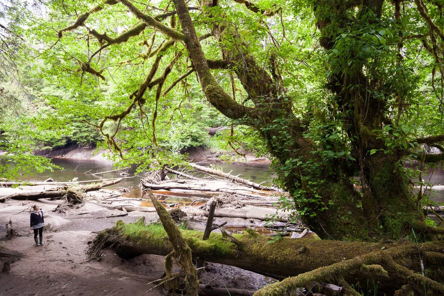
How logging reshapes freshwater systems over decades
2024 Trebek Grantee
Dalal Hanna

Dalal Hanna
The Legacy of Forestry on Freshwaters
Timber harvesting can leave a lasting imprint on freshwater systems. Dalal Hanna is leading a cross-Canada study of streams, sampling 100 sites with varying time since logging in their surrounding area to understand how freshwater systems respond.
When forests are harvested, streams can warm and nutrient levels can shift, with effects reflected in water quality and species diversity.
By comparing recently logged watersheds with those harvested more than 50 years ago, the project tracks change over decades, building a national dataset that links forestry practices to freshwater conditions across regions. Learn More
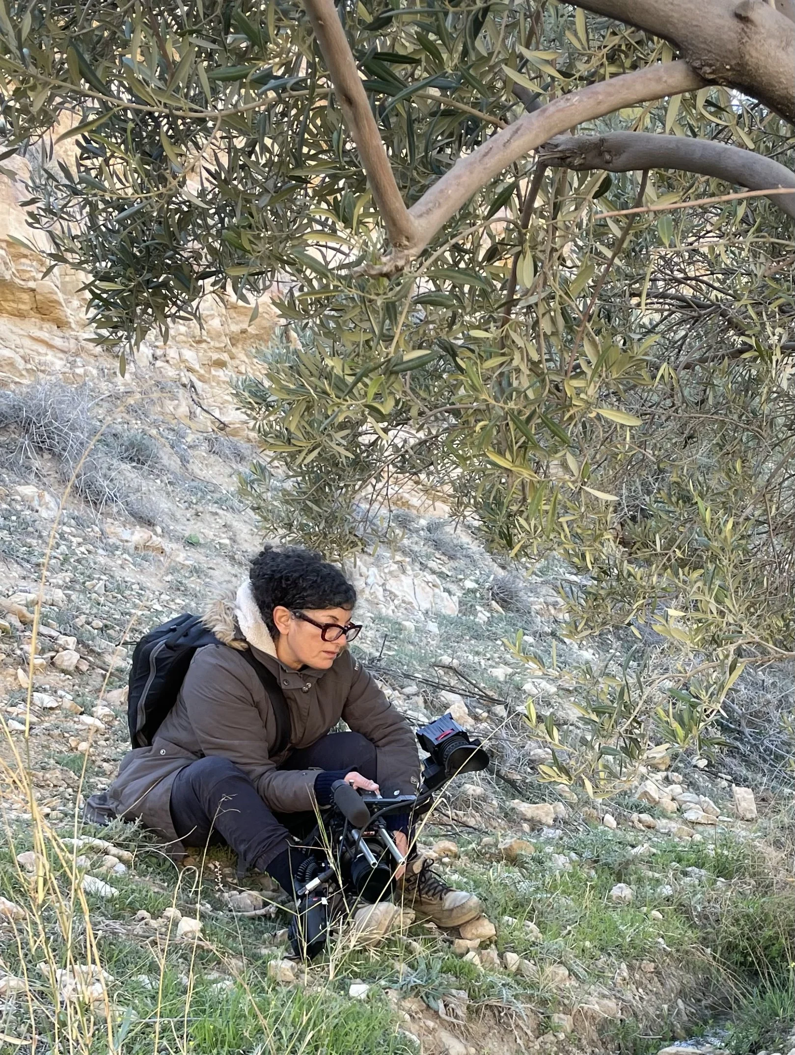
Reading the long-term record of forests and fire
2023 Trebek Grantee
Dorian Gaboriau
Dorian Gaboriau
Deciphering the natural variability of past forest landscapes and fire regimes
Understanding current climate and environmental changes requires looking further back.
Dorian Gaboriau is collecting lake sediment cores across eastern Canada, as archives to reconstruct past forest conditions and fire activity in order to better understand how current dynamics compare with natural variability. These sediment layers preserve ecological records spanning centuries to millennia, revealing patterns of forest change and fire regimes over time.
Fieldwork spans multiple regions in eastern Quebec, including sites explored in collaboration with Indigenous communities in previously underexplored areas, building a record that helps explain how forests and fire patterns have changed over the last 10,000 years.
Photo Credit: TJ Watt
FEATURED PROJECT
WHERE FORESTS STRUGGLE
TO REGENERATE AFTER FIRE
Ellen Whitman - Mapping Forest Vulnerability to Wildfire-Catalyzed Change
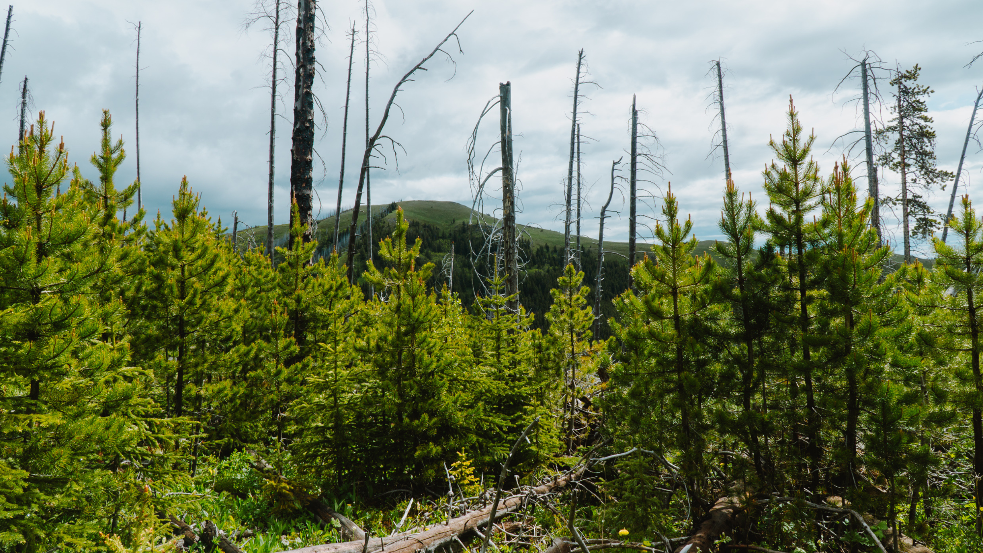
Wildfires are reshaping western Canada at a pace and scale not seen before. While many forests have historically recovered after fire, that pattern is shifting in some regions.
Ellen Whitman studied how wildfire and climate interact to influence forest recovery in high-elevation and northern forests where conditions already limit tree growth. In these areas, the post-fire period is critical, as seedlings must establish under changing conditions.
Her team conducted fieldwork across a broad latitudinal range, from southern Alberta to the Yukon, working with Indigenous partners and provincial agencies to compare recovery across burned and unburned sites. In some areas, forests are regenerating as expected, while in others, regeneration is limited or absent, with vegetation shifting to different species.
By combining field observations, climate data, and remote sensing, the project identifies where forests are least likely to recover after wildfire. These findings point to areas where recovery may no longer follow historical patterns and where landscapes may shift to new ecosystem types, informing forest planning and management. If forests fail to return after wildfire, the impacts extend beyond trees, affecting wildlife habitat, carbon storage, and the future character of western Canadian landscapes. Learn More

2024 Trebek Grantee | Ellen Whitman
Project Outcomes:
Field surveys across more than 100 sites spanning multiple fire-affected regions
Comparative data on forest recovery under different climate conditions
Identification of areas at risk of post-fire regeneration failure
Predictive mapping of forest vulnerability across western Canada
Findings shared through publications and used in forest management
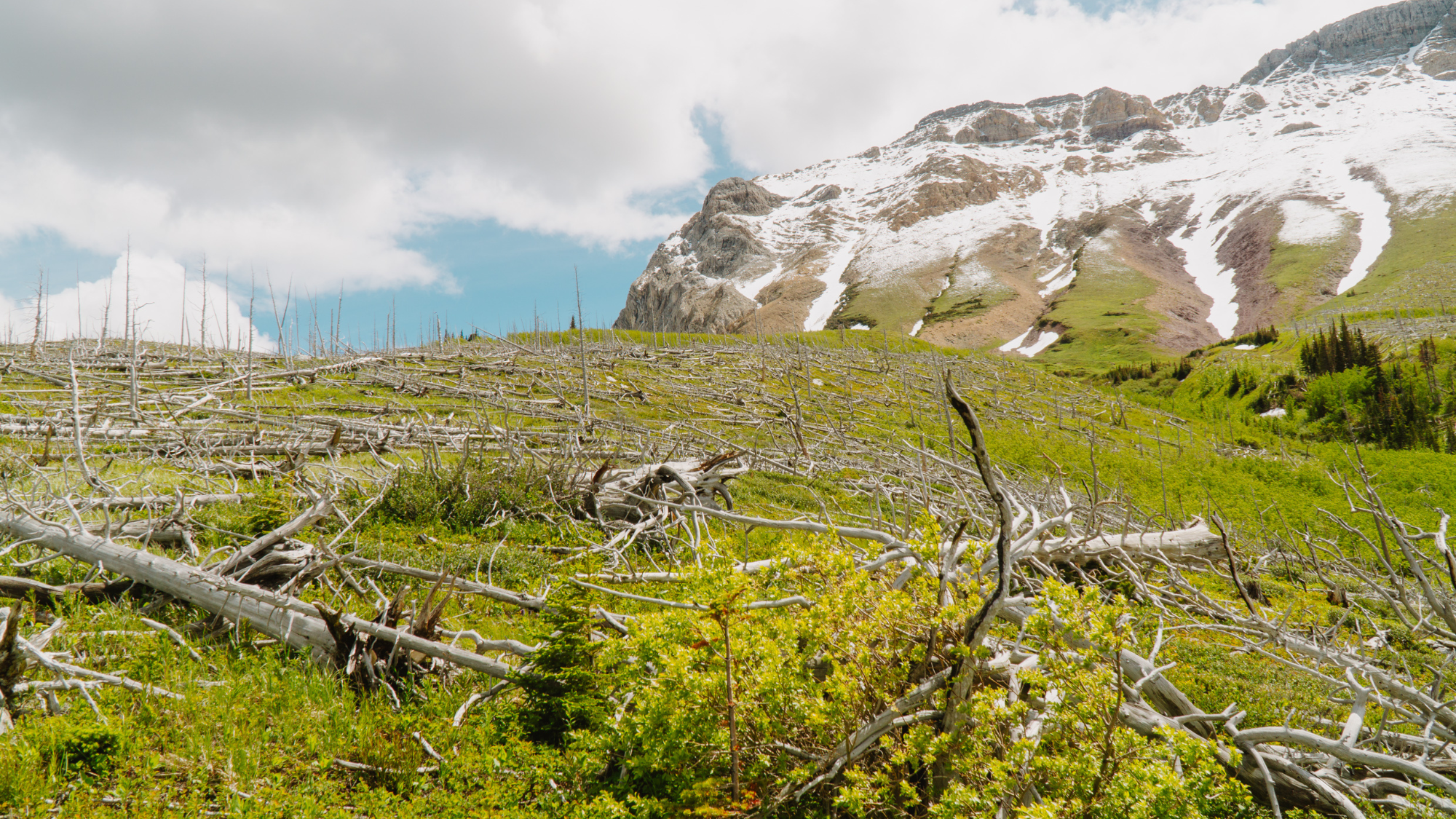
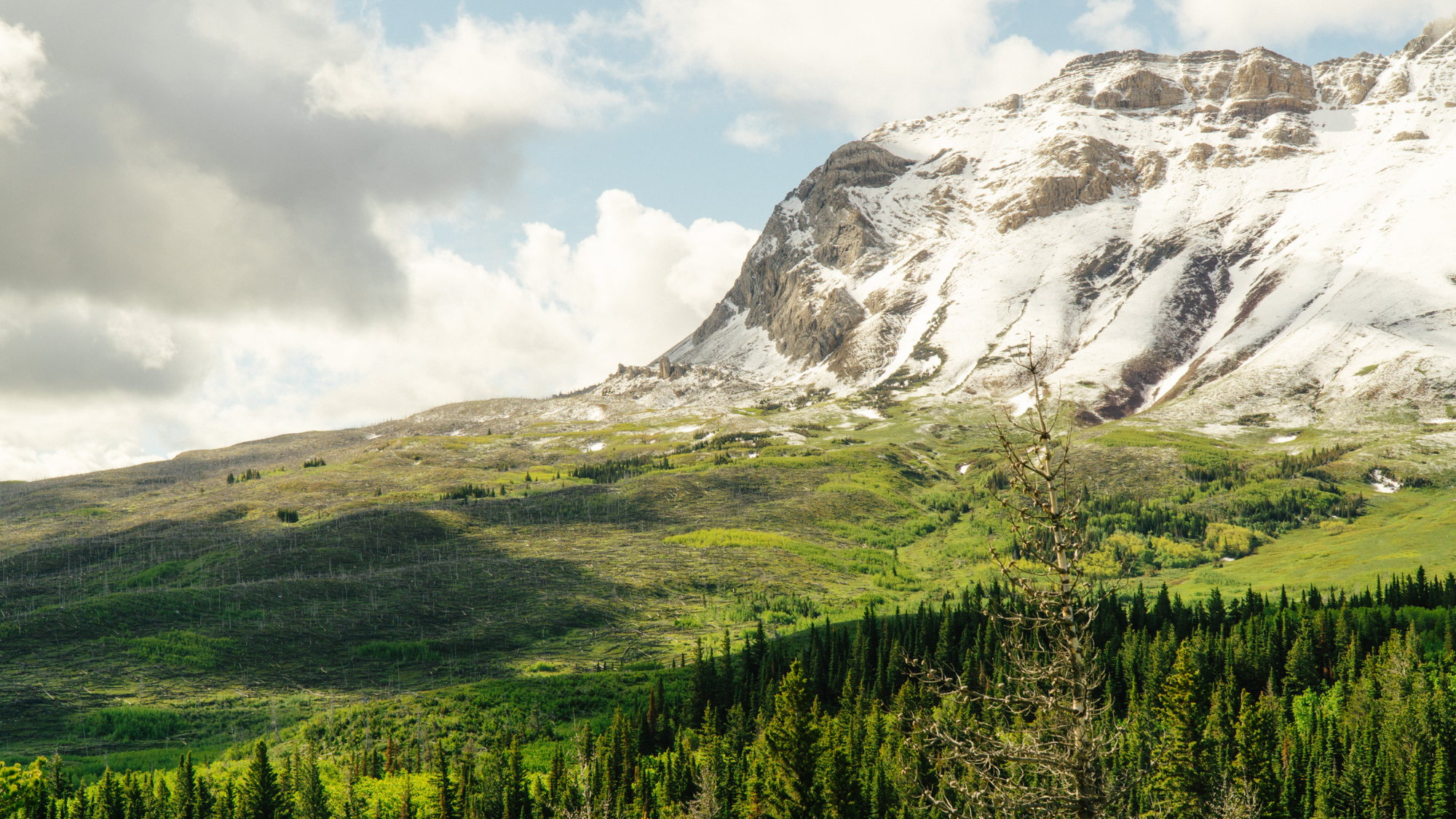
A severely burned landscape with little tree regeneration. In some areas, forests are not returning as expected after wildfire, raising questions about how these ecosystems may change in the decades ahead.
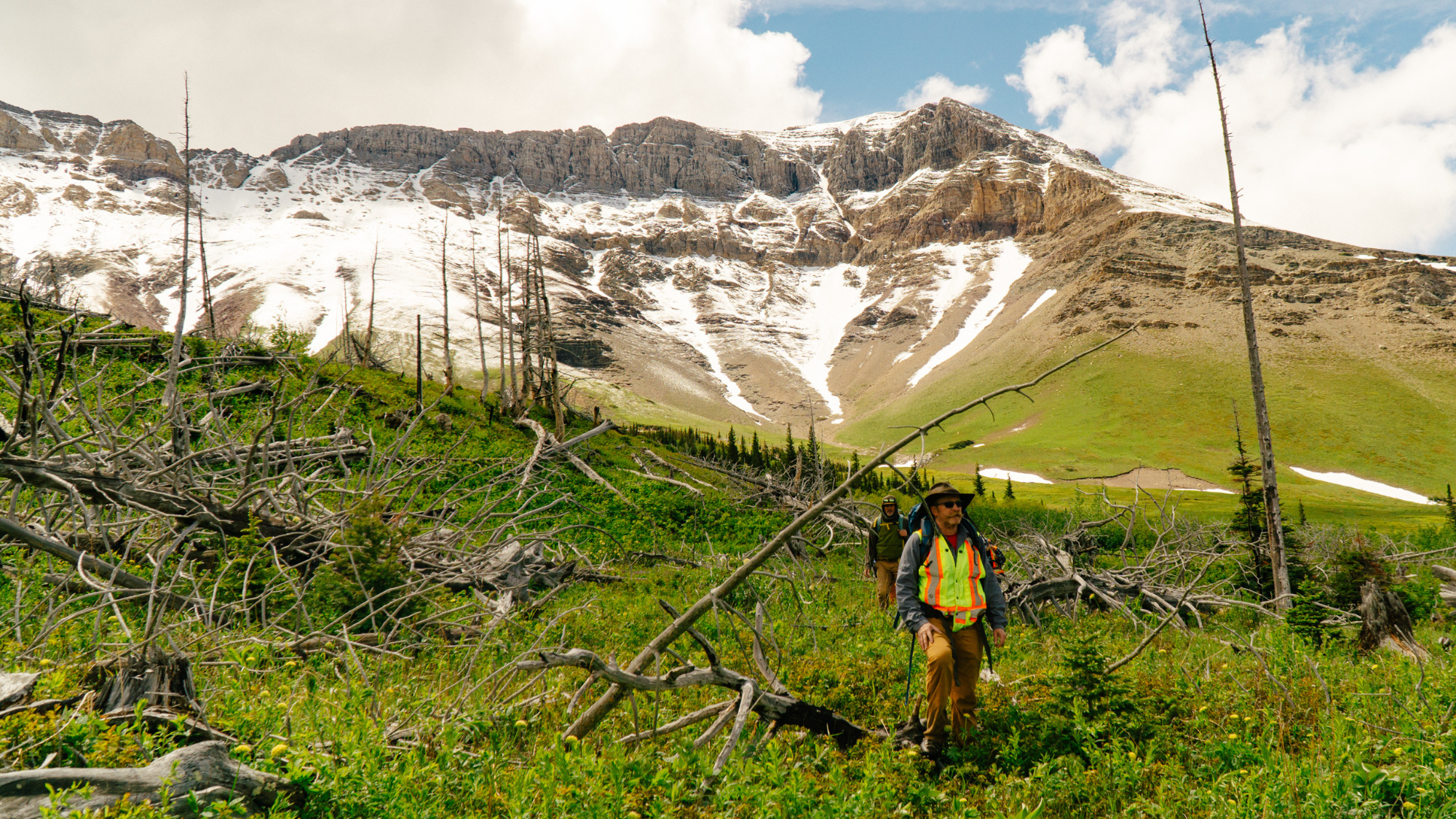
Researchers Sean Parks and Jonathan Coop hike through a burned landscape in Waterton Lakes National Park. Ellen Whitman’s team travelled across western Canada to document how forests are responding to increasingly large and severe wildfires.
A large high-severity burn patch in Waterton Lakes National Park. Some areas remain forested while others were almost completely killed by fire, creating a natural laboratory for studying recovery across the landscape.
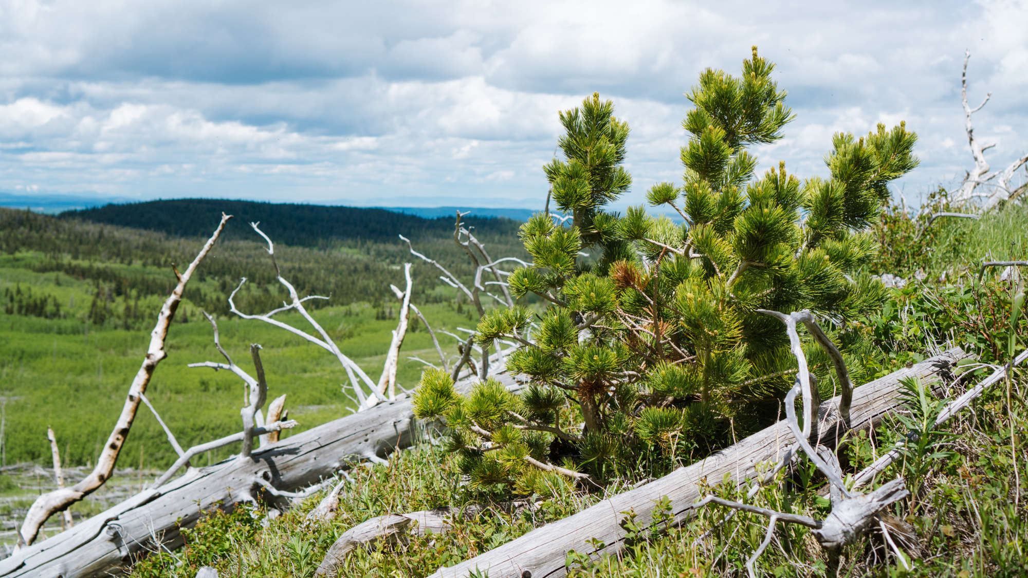
A young whitebark pine seedling grows among fire-killed trees. Even in heavily burned areas, new forests can emerge, though success depends on factors such as seed availability, climate, and site conditions.
Pine seedlings emerging among dead trees in the Crowsnest Pass. These young trees offer a glimpse of what the next generation of forest may look like and help researchers understand where recovery is most likely to succeed.
IMPACT BEYOND
THE TREBEK GRANT
PREVENTING FOREST LOSS
WITH PROTECTED AREAS
TJ Watt – Exploring & Documenting Endangered Ancient Forests in BC
Across British Columbia, efforts to protect old-growth forests are increasingly focused on supporting Indigenous-led conservation initiatives and the long-term protection of entire ecosystems.
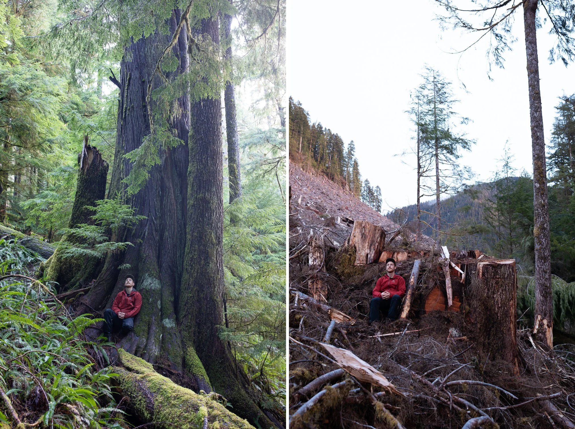
Through his Trebek-supported project, TJ Watt documented the loss of endangered old-growth forests through before-and-after photography, revealing the impacts of clear-cut logging on forests with trees 500 to 1,000 years old. By revisiting the same locations before and after they were logged, his images revealed the destruction of irreplaceable ancient forests happening far from public view.
This work helped bring widespread attention to the loss of old-growth forests through Watt’s role as co-founder of the Ancient Forest Alliance, where his photographs and advocacy have played a major part in shaping conservation policy across British Columbia. His explorations have also uncovered some of the largest and most extraordinary ancient trees remaining in Canada.
Building on this foundation, TJ is now also involved with the Nature-Based Solutions Foundation, which helps secure conservation financing to support First Nations in establishing new protected areas and creating conservation-based economies as alternatives to old-growth logging. While his work documenting both the beauty and destruction of ancient forests continues, it has also expanded to helping communities permanently safeguard thousands of hectares of endangered ecosystems for future generations.
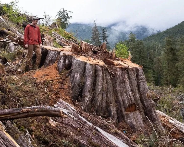
What remains after an old-growth forest is cut. In the Caycuse Valley, TJ Watt’s powerful visual evidence of forests that can take centuries to grow and only days to disappear.
Project Outcomes:
Before-and-after photography documenting old-growth forest loss in threatened landscapes
National and international media coverage raising awareness of endangered ancient forests
Collaboration with Indigenous Nations and local communities on long-term conservation initiatives
Development of a conservation financing model supporting new protected areas
Direct support for Indigenous Protected Areas that will safeguard more than 400 km² of old-growth forests
MEET OUR NEW GRANTEES
Each year, Trebek supports people exploring some of the most important changes taking place across Canada. Meet our newest grantees as they introduce their projects in their own words.
INTRODUCING THE 2026 GRANT RECIPIENTS
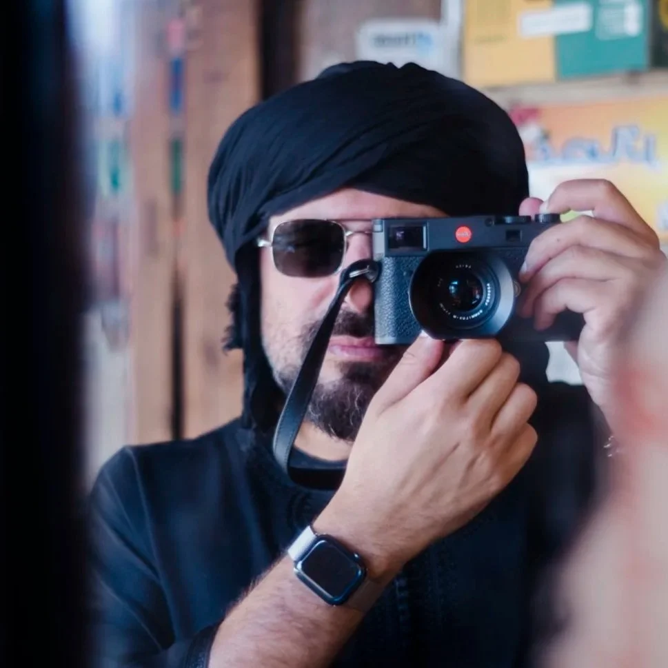
MICHAEL CHRISTOPHER BROWN
Sacred Balance: Climate Change & Co‑Stewardship in the Muskwa‑Kechika
The Muskwa-Kechika Management Area in northern British Columbia is one of the largest intact wilderness regions in North America: six million hectares of roadless mountains, rivers, and valleys that have been cared for by the Kaska Dena and other First Nations for thousands of years. At its heart flows the Kechika River, a vast corridor for wildlife like moose, caribou, and grizzly bears to move and adapt as the climate changes.
Nearly two decades after first photographing this region for National Geographic Magazine, I am returning to document how the land and its people are responding to accelerating climate shifts—warmer winters, melting permafrost, and changing wildlife patterns. Working alongside Kaska Dena Land Guardians, Elders, and youth, our project, Sacred Balance, will combine traditional knowledge and science to document this transformation through storytelling, including imagery, sound and mapping.
Together we’ll create a visual record of change that includes repeat photography, motion and audio, and an interactive StoryMap that weaves together maps, voices, and stories from the Kechika basin.
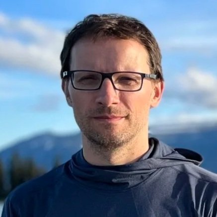
DR. EDWIN NISSEN
A new source of earthquakes and tsunamis shaping Vancouver Island’s iconic west coast
Vancouver Island’s outer coast is one of Canada’s most iconic landscapes, but also its most important locus of earthquakes and tsunamis. It constitutes the northern ~300 km of the ~1,000 km-long Cascadia subduction zone, where the oceanic Juan de Fuca plate plunges beneath continental North America along a gently-dipping “megathrust” fault that surfaces ~100 km offshore.
Currently locked, the fault is steadily accumulating tectonic strain that the inevitable next Cascadia earthquake and tsunami will release. However, since the last such event occurred in 1700 CE (well before modern observations), exactly what the next one will look like remains unclear. An important clue can be found in our unexpected discovery of a surface rupture on Flores Island, within the haḥuułi (traditional territory) of the ʕaaḥuusʔatḥ (Ahousaht) First Nation in Clayoquot Sound, BC. We hypothesize that the fault, which lies within the upper North American plate and is the first of its type recognized anywhere in Cascadia, was generated by a particularly large offshore megathrust earthquake, possibly the one in 1700 CE. We will test this by determining the rupture age using a suite of field sampling and dating techniques and comparing it with the known chronology of megathrust earthquakes.
The project sheds light on a "worst-case scenario" Cascadia earthquake and tsunami, provides a vital benchmark for improving early warning systems and evacuation measures, and illuminates the tectonic forces shaping Canada’s Pacific margin.
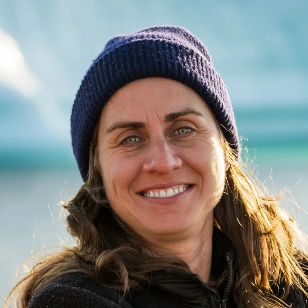
VALERIA VERGARA
Listening to whales: using hydrophones, drones, and AI to unravel killer whale communication dynamics
Killer whales live in tight-knit societies held together by sound. In Northern Resident killer whales, each pod has its own distinct dialect, passed down through generations, a remarkable example of non-human culture. Yet even after decades of study, we still don’t know what most of these calls mean or how whales use them to navigate their complex social lives.
This project brings together whale biologists and AI researchers to explore orca communication through a new, integrated approach. Using synchronized underwater recordings, drone footage, and machine learning, we aim to link specific calls to the behaviours, social roles, and group contexts in which they occur, and to understand how human ocean noise disrupts their vital interactions. By studying both fish-eating Northern Resident and mammal-eating Bigg’s killer whales, we can compare how communication strategies evolve across ecotypes with different diets, social systems, and vocal behaviours.
A successful 2025 pilot proved this approach is feasible under field conditions on the NE coast of Vancouver Island. Our next phase will expand this work, laying the foundation for a standardized, cross-population framework for studying killer whale communication that connects to a planned parallel effort in Iceland. By listening closely to these whales, we will deepen our understanding of their cultural richness and help design and advocate for strategies to restore the quality of their acoustic environment.
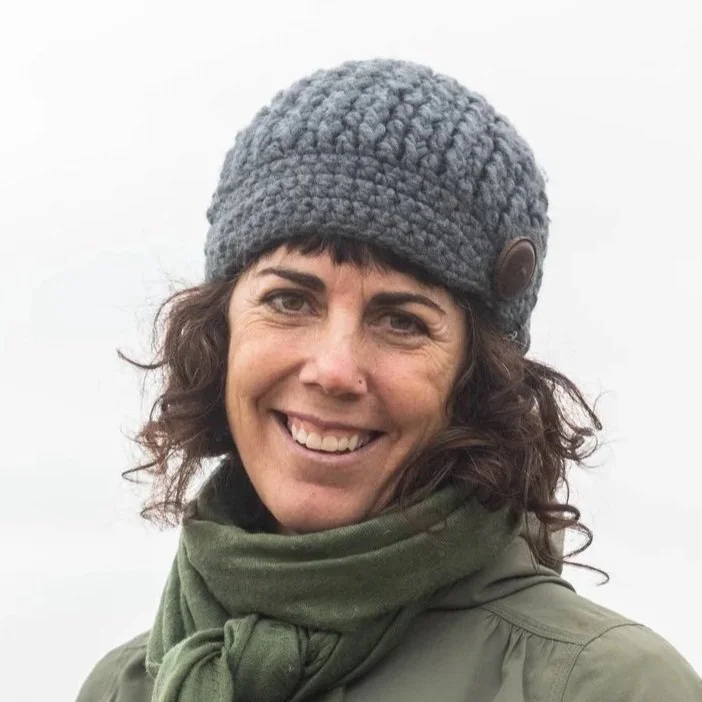
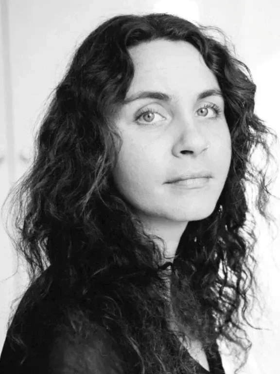
RAQUEL ALFARO SÁNCHEZ
Tracking Climate-Driven Shifts in Canada’s Latitudinal Treeline
The transition from boreal forest to tundra in northern Canada, where forest cover becomes sparse and patchy, marks a sensitive ecological boundary in which even small climate shifts can trigger major landscape changes. Yet, because of its remoteness, this treeline zone remains one of Canada's least studied regions.
With support from the Trebek Initiative, I will navigate the Coppermine River in Nunavut to explore 469 km² of Canada’s northern treeline, studying how the dominant tree and shrub species are responding to a rapidly warming climate and determining whether the boreal forest is advancing northward beyond its current limits. This expedition will provide essential ground-based insight into how climate change is reshaping Canada’s northern ecosystems.
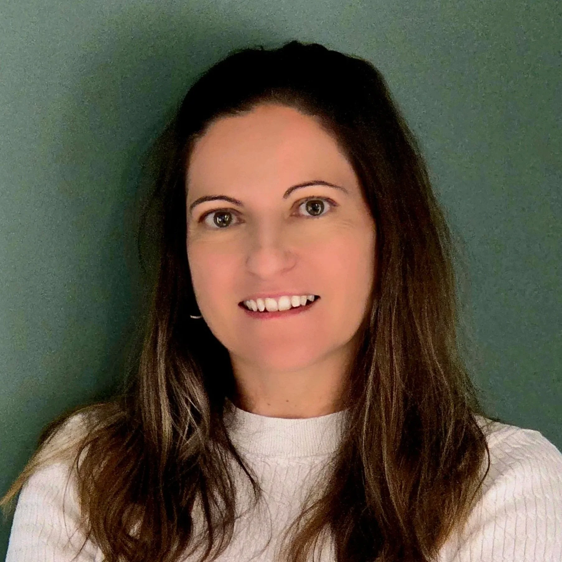
MÔNICA TAÍS ENGEL
Water Bears and People on Canada’s Eastern Edge
Along the coast of Newfoundland and Labrador, people have observed a rise in polar bears walking through backyards, breaking into cabins, venturing into hot tubs, and often posing a risk to themselves and pets. The ice is melting faster, and bears from the Davis Strait subpopulation are likely spending more time on land. Their migration routes also cross coastal communities, so encounters with people are almost inevitable when they are not on the water. This can create challenges for bears, coastal residents, wildlife managers, and policymakers. Coexisting with polar bears takes many forms, but without understanding what is happening in the region, mapping these interactions, and learning from past encounters, decision-making will always have a blind spot, and conflict is likely to grow without preventive planning.
My project is exciting because it will be the first to systematically document and map human-polar bear interactions on the island of Newfoundland, combining evidence from historical and current media, interviews with people who have encountered bears and those responsible for managing these interactions. With a strong storytelling component, we will produce a documentary and deploy trail cameras near the communities to document bear sightings along their terrestrial migration paths. We will also be looking for a long-suspected but undocumented denning site in the area. If we find any evidence that suggests bears are spending more time in the area or even denning, this discovery would have a massive impact on our understanding of critical maternal habitats in the Davis Strait.
This project provides a perfect case for exploring when people stop being tolerant of polar bears and conflict becomes an issue for managers, communities, and policymakers. It is about learning what it means to coexist with polar bears.
M’HAMMED KILITO
Confluences: A Human and Aquatic Cartography of the Laurentian System
Confluences Confluences is a photographic expedition following the 3,700-kilometre course of the St. Lawrence River from Lake Ontario to the Atlantic Ocean. Created in collaboration with local communities, it tells the story of those who live along the river and explores how they influence it and how it, in turn, shapes their lives. I will take a road trip along its shores, photographing the life of its cities, the traces left by its industries, and the strength of the people who inhabit its banks. Canada’s greatest river stands at a turning point, facing the combined pressures of industry, climate change, and pollution.
The journey will begin in Kingston, where the river flows out of Lake Ontario, and will continue through Cornwall, Montreal, Trois Rivières, Québec City, the Gaspé Peninsula, Tadoussac, and Havre-Saint-Pierre, reaching the Innu community of Ekuanitshit, where residents experience ecological transformations firsthand and speak out about the changes they witness. It will end on the Lower North Shore and the Magdalen Islands, where coastal erosion and rising seas threaten people’s ways of life.
Along the way, I will meet individuals from many backgrounds, including workers, farmers, scientists, artists, and fishermen whose experiences together reveal how deeply our lives are connected to the river and to the landscapes that sustain us.
GRANTEE AWARDS + RECOGNITION
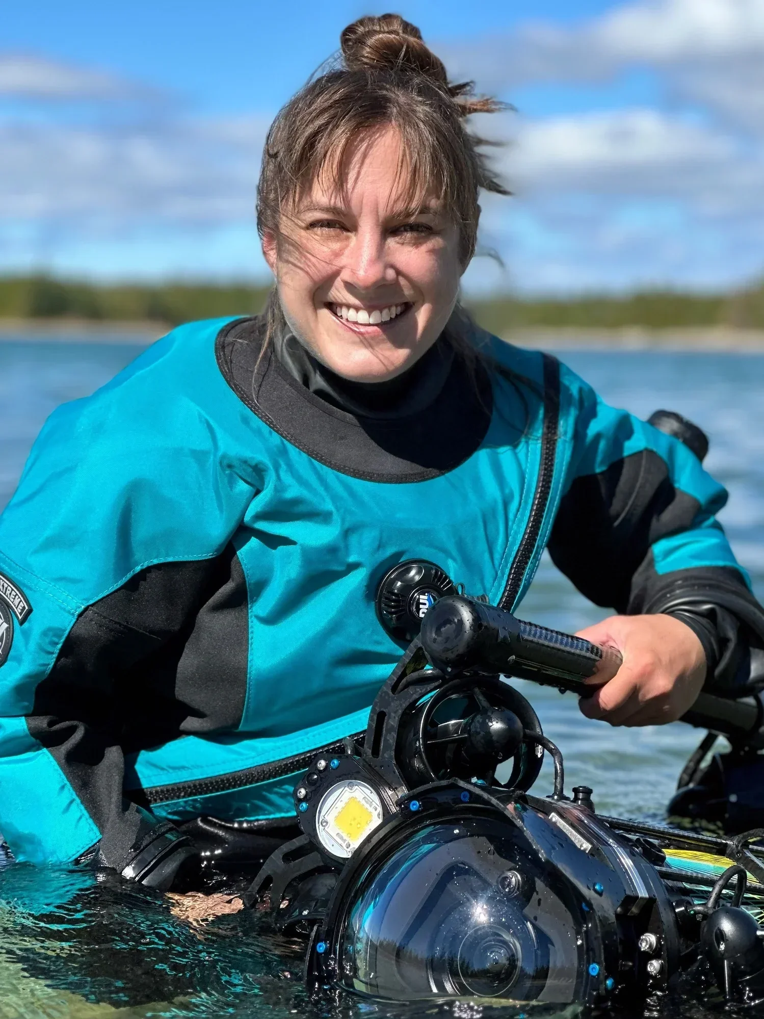
2022 TREBEK GRANTEE | YVONNE DREBERT | GREAT LAKES EXPLORATION
Yvonne Drebert has been named a 2026 National Geographic Wayfinder Award recipient, an honour recognizing individuals whose work advances exploration, science, conservation and storytelling.
An underwater filmmaker and explorer, Yvonne uses advanced underwater drones to reveal freshwater environments that are rarely seen. Her work applies ocean exploration techniques to the Great Lakes, documenting submerged landscapes and ecosystems while expanding how freshwater systems are studied and understood.
Presented by the National Geographic Society, the Wayfinder Award celebrates a global cohort of changemakers whose work is helping shape a more sustainable and informed future.
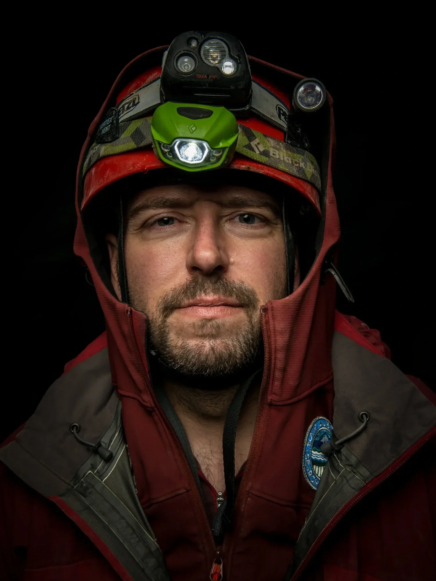
2021 TREBEK GRANTEE | CHRISTIAN STENNER | GLACIOVOLCANIC CAVES
Christian Stenner is featured in the National Geographic Learning Launchpad, a new educational experience within the National Geographic Museum of Exploration in Washington, D.C.
The interactive exhibit uses the work of National Geographic Explorers to introduce students to geographic thinking and the Explorer Mindset. Christian's exploration of glaciovolcanic caves is featured as part of that experience, helping visitors learn about one of Canada's most unusual and least understood environments.
The Learning Launchpad will be experienced by thousands of visitors each year, connecting students with exploration, science, and discovery through real-world examples from the field.
2021 TREBEK GRANTEE | SARA HYLTON | WE HAD ALL KINDS OF WATER
Sara Hylton received the Silver Award in Photo Essay and Photojournalism at the National Magazine Awards for her photography accompanying Brandi Morin's Canadian Geographic feature, We Had All Kinds of Water.
Using medium-format film photography, Sara documented life in Neskantaga First Nation as the community lived through the longest-running boil water advisory in Canadian history. Her images accompanied Morin's reporting, offering a powerful visual record of a community navigating the challenges and consequences of more than three decades without access to safe drinking water.
The award recognizes a collaboration that combined in-depth reporting and photography to document a story of national significance. Read Article
2024 TREBEK GRANTEE | ISABELLE GROC | SHOREBIRDS: SENTINELS OF THE MUDFLATS
Isabelle Groc has received the Silver Award for Best Science and Technology Storytelling at the 11th Annual Digital Publishing Awards for her Canadian Geographic feature, The Magic in the Mud.
Combining reporting and conservation photography, the story explores the critical role of biofilm in sustaining western sandpipers during their 10,000-kilometre migration along the Pacific Flyway. By highlighting this often-overlooked food source on the Roberts Bank mudflats, Isabelle brings attention to the ecological importance of one of Canada's most significant migratory stopovers.
The recognition adds to a growing list of honours for the project, including an international AAAS Kavli Science Journalism Award. Her documentary Sandpipers' Last Supper has also received four LEO Award nominations, including Best Direction and Best Screenwriting. Read Article
UPCOMING EVENTS
Through a new partnership with Exploring By The Seat Of Your Pants, Trebek Grantees are connecting with students through live virtual field experiences. Created by National Geographic Explorer Joe Grabowski, the platform has reached more than 1.5 million students in over 113 countries.
Our first Trebek sessions launched this spring, connecting students with grantees working across Canada. Additional events will return in the fall when schools are back in session. In the meantime, you can explore the recordings of two recent presentations below.
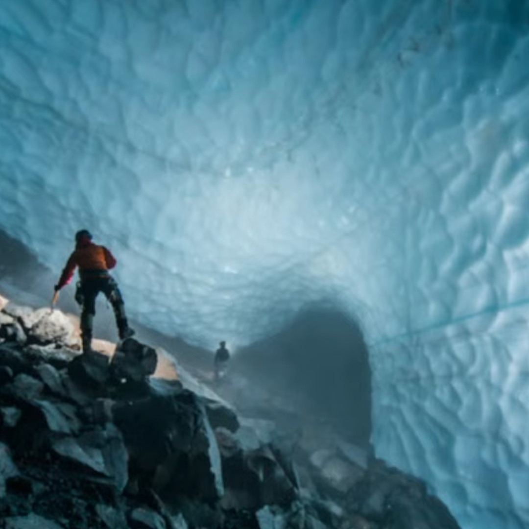
Wild Caving with Christian Stenner
Venture into some of the darkest and most unique places inside the Earth: Caves formed where glacier ice and volcanic heat interact, creating otherworldly environments that are both cold and hot at the same time. Christian Stenner has explored the largest and deepest of the world’s glaciovolcanic caves. Caves that tell us about volcanic activity and changing climate, the extreme microorganisms that can survive there, and how we might first find life on other planets.
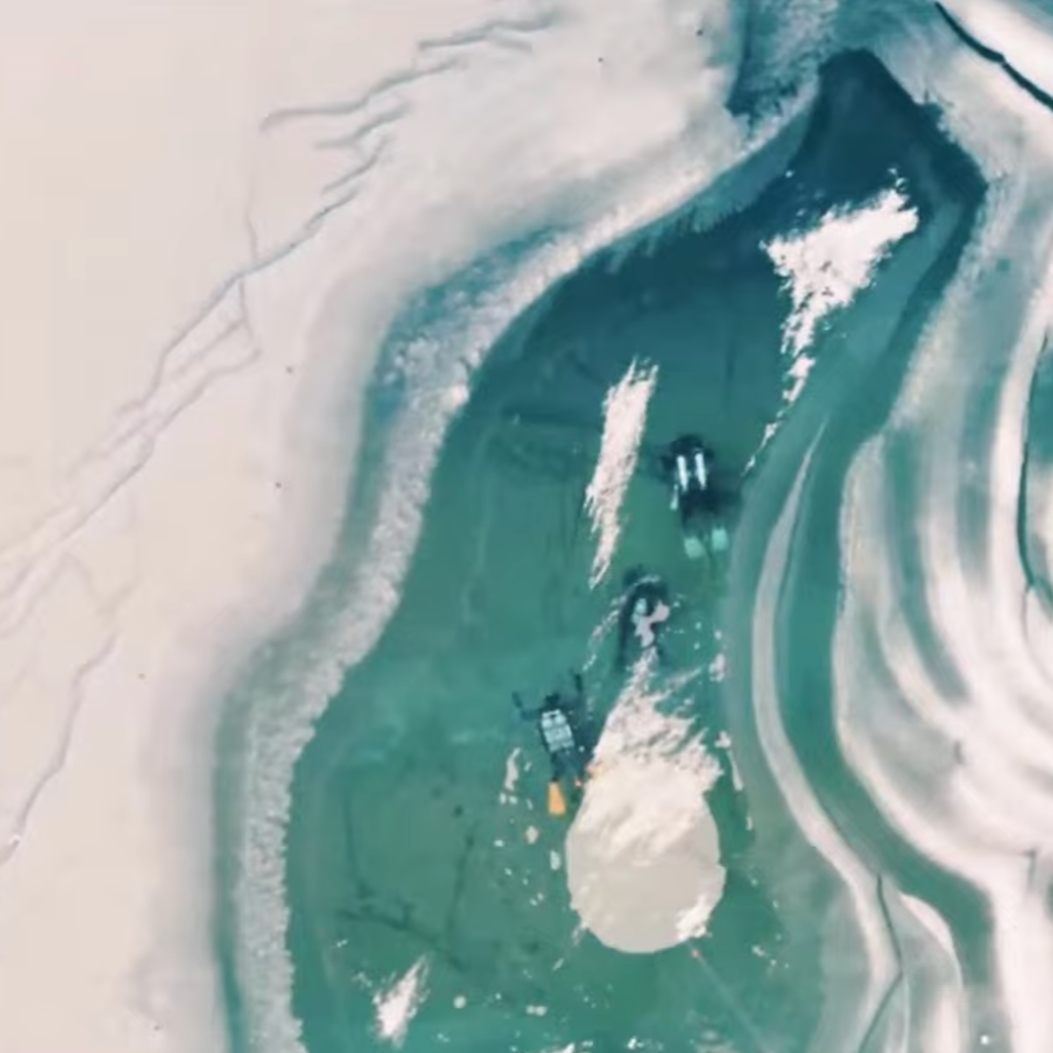
Freeze the Future – Exploring Frozen Lakes with Andrew Budziak
Explore a hidden world beneath the ice. Canadian explorer, filmmaker, and wildlife photographer Andrew Budziak leads Freeze The Future, a project that takes divers beneath frozen lakes to study microscopic algae and understand how climate change is affecting freshwater ecosystems. Through film, science, and exploration, Andrew reveals that some of the most important discoveries can be found much closer to home than we might expect.

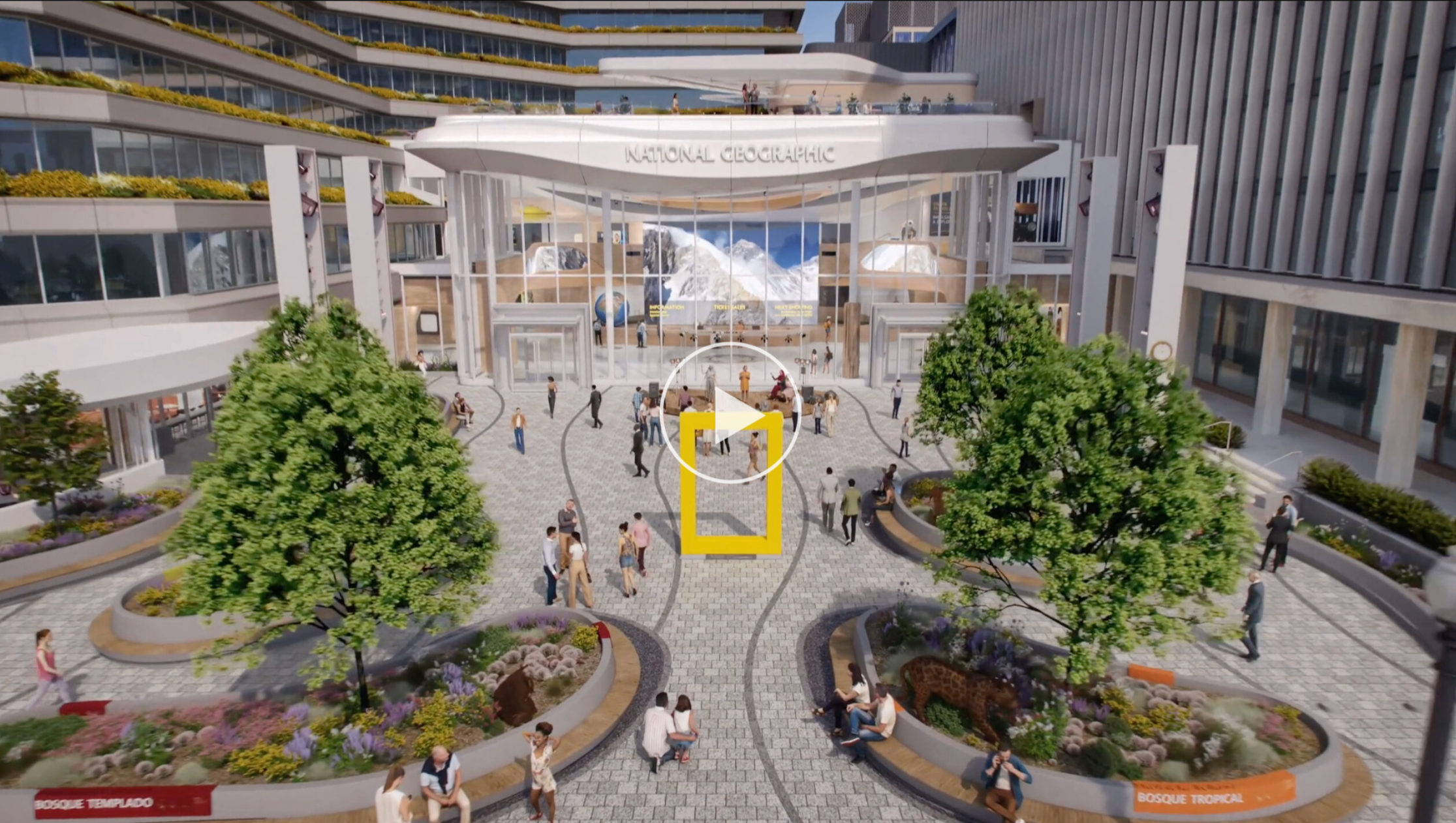
NATIONAL GEOGRAPHIC BASE CAMP OPENS ITS DOORS
For more than a century, National Geographic has pursued a mission to illuminate and protect the wonder of our world. This summer marks a new chapter with the opening of Base Camp, a reimagined campus in Washington, D.C., designed to bring that mission to life through exploration, storytelling, education and public engagement.
Created as a place where explorers can share discoveries and connect with the public, Base Camp will feature exhibits, storytelling and opportunities for collaboration. By bringing together explorers, young learners and changemakers, the new campus aims to inspire curiosity, give visitors a deeper understanding of the world around them and help illuminate the path to a more sustainable future.
Watch the flythrough video below for a preview of the new space.

GEOGRAPHICA 2026
Canada's largest annual fundraiser for exploration and geographic education returns to Ottawa on November 4, 2026.
This year's Geographica, Journey to the Stars, will celebrate Canada's contributions to space exploration through an evening of storytelling, photography, film, cuisine, and conversation. Bringing together astronauts, explorers, researchers, educators, and supporters, the event highlights the people helping expand our understanding of the world and beyond.
Proceeds support the Royal Canadian Geographical Society's programs in exploration, education, and research.
Follow us on Instagram
@trebekinitiative
THANK YOU
Your commitment fuels our Trebek Grantees’ efforts to make a meaningful impact across Canada, whether they’re uncovering
solutions to urgent challenges, preserving cultural heritage, or inspiring the next generation of scientists, storytellers, and educators.
Together, we’re igniting a passion to preserve across Canada.
