Ce trimestre chez Trebek
Numéro 8
| juin 2026
TREBEK OBSERVE
LA FORÊT
Les forêts sont en constante évolution. Les feux, le climat, la faune et les activités humaines façonnent le paysage. Dans ce numéro, nous suivons des chercheurs, des photographes et des détenteurs de savoirs autochtones qui nous aident à mieux comprendre ce que ces changements signifient pour l’avenir des forêts canadiennes.
DANS CE NUMÉRO
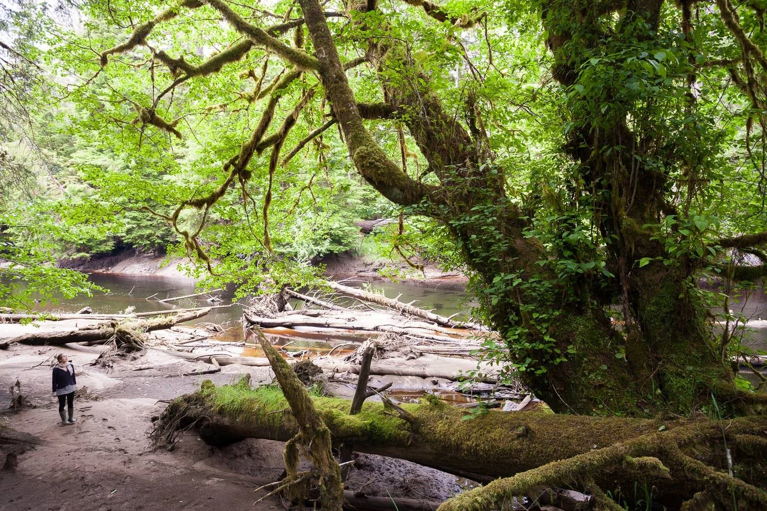
TREBEK OBSERVE LA FORÊT: Annie Sakkab explore ce qui se perd lorsque des forêts anciennes sont transformées en produits de consommation courante. Dalal Hanna examine comment l’exploitation forestière modifie les écosystèmes d’eau douce au fil du temps. Dorian Gaboriau reconstitue l’histoire des forêts et des feux afin de mieux comprendre l’évolution de ces systèmes à travers les régions du Canada.
AU-DELÀ DE LA SUBVENTION TREBEK : Après des années à documenter la disparition des forêts anciennes menacées, le bénéficiaire Trebek 2021 TJ Watt contribue aujourd’hui à faire progresser des initiatives de financement de la conservation qui soutiennent la création de nouvelles aires protégées et la gestion menée par les peuples autochtones afin de préserver des forêts anciennes d’importance écologique.
ANNONCE DES PROJETS 2026 : Découvrez les six nouveaux bénéficiaires Trebek. Leurs projets portent notamment sur l’intendance autochtone dans la région de Muskwa-Kechika, les risques de séismes et de tsunamis sur la côte du Pacifique, la communication des épaulards, la réponse des forêts nordiques canadiennes au réchauffement climatique, la cohabitation entre les humains et les ours polaires à Terre-Neuve-et-Labrador, ainsi qu’un parcours photographique le long du fleuve Saint-Laurent.
PROJET VEDETTE : La bénéficiaire Trebek 2024 Ellen Whitman étudie comment les feux de forêt et les changements climatiques transforment la régénération des forêts dans l’Ouest canadien, afin de mieux comprendre où le rétablissement des écosystèmes est le plus vulnérable et d’éclairer les pratiques de gestion forestière.
Photo Credit: TJ Watt .
TREBEK OBSERVE
LA FORÊT
Comment les forêts en changement transforment les terres et les eaux
Les forêts canadiennes évoluent de façons qui ne sont pas toujours immédiatement visibles. Dans certains endroits, les paysages se transforment en quelques années. Ailleurs, les changements se manifestent plus lentement, influençant les systèmes d’eau douce et la régénération des écosystèmes pendant des décennies. Ces transformations façonnent les milieux naturels et révèlent ce que les forêts canadiennes peuvent nous apprendre sur un avenir en changement.
Les trois projets présentés ci-dessous abordent les changements forestiers sous différents angles. Ensemble, ils explorent les conséquences de la disparition des forêts anciennes, les effets durables de l’exploitation forestière sur les écosystèmes d’eau douce et les archives écologiques qui montrent comment les forêts et les feux ont façonné le paysage pendant des millénaires.
Les effets de la perte des forêts sur les terres, les eaux et les communautés.
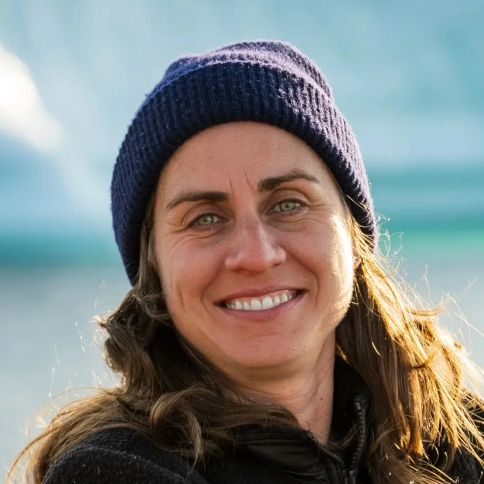
Bénéficiaire Trebek 2025
Annie Sakkab
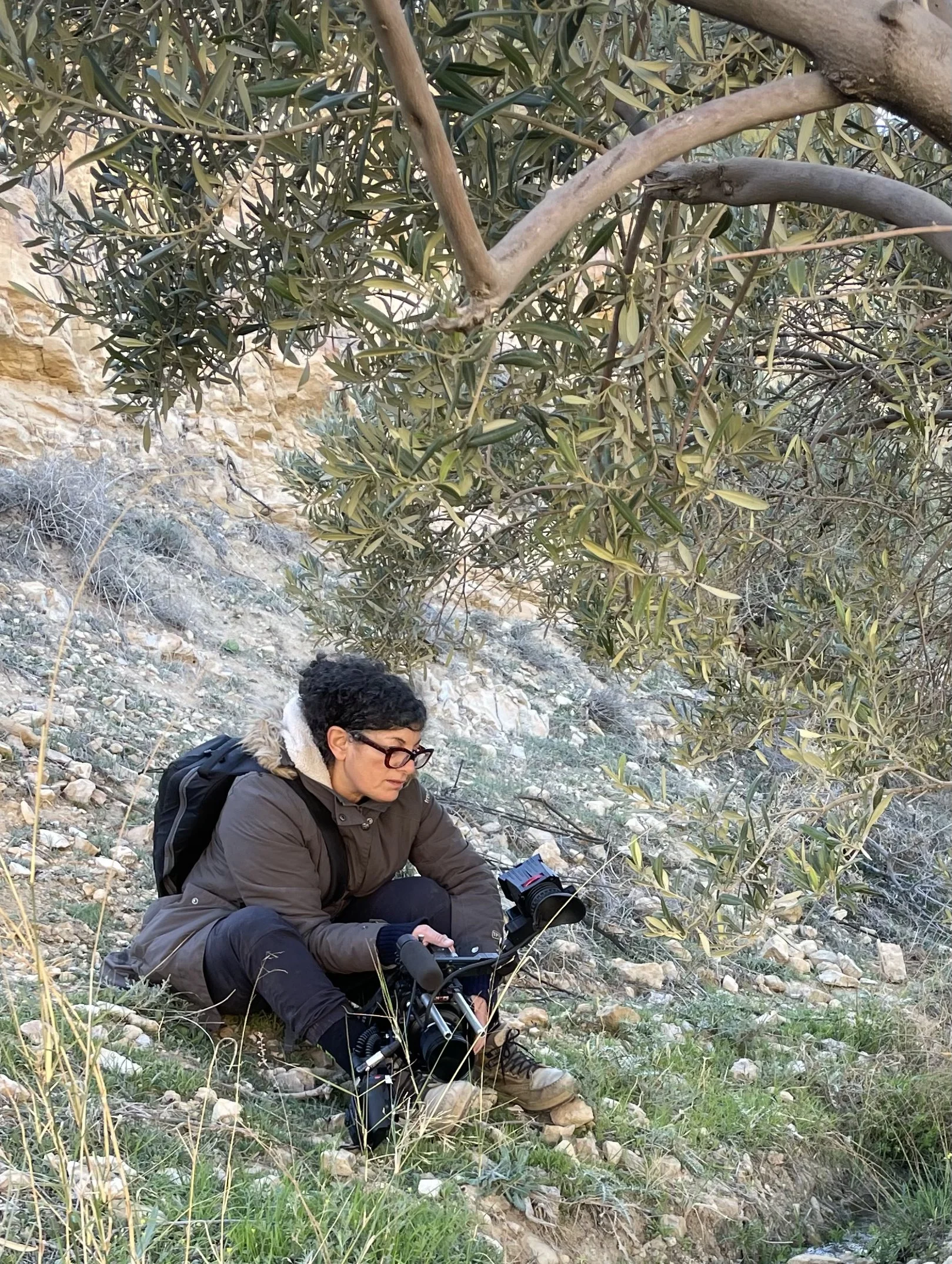
Annie Sakkab
Disposable Forests: The Boreal Forest Sacrificed for Softness
Dans certaines régions de la forêt boréale canadienne, l’exploitation forestière liée à des produits de consommation comme le papier-mouchoir touche certaines des plus vieilles forêts du pays, notamment des arbres centenaires et des écosystèmes qui ont mis tout aussi longtemps à se développer.
Annie Sakkab prépare un projet photographique qui suivra les liens entre la perte des forêts, les écosystèmes d’eau douce et les communautés qui en dépendent. Par la photographie et le reportage, elle explorera comment cette perte se manifeste dans la vie quotidienne et comment ses répercussions s’étendent bien au-delà des zones de récolte.
En suivant ces liens, le projet examinera ce qui est en jeu lorsque des forêts anciennes et les sols profonds qui les soutiennent, façonnés au fil des siècles, sont transformés en produits utilisés pendant une période éphémère.
Les effets à long terme de l’exploitation forestière sur les écosystèmes d’eau douce
Bénéficiaire Trebek 2024
Dalal Hanna

Dalal Hanna
The Legacy of Forestry on Freshwaters
TL’exploitation forestière peut laisser une empreinte durable sur les écosystèmes d’eau douce. Dalal Hanna dirige une étude pancanadienne sur les cours d’eau, analysant 100 sites où l’intensité et l’ancienneté de l’exploitation forestière varient afin de mieux comprendre comment ces écosystèmes réagissent au fil du temps.
Lorsque les forêts sont récoltées, les cours d’eau peuvent se réchauffer et les concentrations de nutriments se modifier, avec des effets qui se reflètent dans la qualité de l’eau et la diversité des espèces.
En comparant des bassins versants récemment exploités à d’autres récoltés il y a plus de 50 ans, le projet suit l’évolution de ces changements sur plusieurs décennies et contribue à la création d’un ensemble de données national reliant les pratiques forestières à l’état des écosystèmes d’eau douce à travers le pays. En savoir plus
Retracer l’histoire des forêts et des feux
Bénéficiaire Trebek 2025
Dorian Gaboriau
Dorian Gaboriau
Deciphering the natural variability of past forest landscapes and fire regimes
Comprendre les changements climatiques et environnementaux actuels exige de remonter plus loin dans le temps.
Dorian Gaboriau recueille des carottes de sédiments lacustres dans l’est du Canada afin de reconstituer les conditions forestières passées et l’activité des feux. Ces archives naturelles permettent de comparer les dynamiques actuelles à la variabilité naturelle observée au fil du temps. Les couches de sédiments conservent des traces écologiques remontant sur des centaines, voire des milliers d’années, révélant l’évolution des forêts et des régimes de feu.
Les travaux de terrain se déroulent dans plusieurs régions de l’est du Québec, y compris sur des sites étudiés en collaboration avec des communautés autochtones dans des territoires encore peu documentés. Ensemble, ces données contribuent à mieux comprendre l’évolution des forêts et des feux au cours des 10 000 dernières années.
Photo Credit: TJ Watt
PROJET VEDETTE
LÀ OÙ LES FORÊTS PEINENT À SE RÉGÉNÉRER APRÈS LES FEUX
Ellen Whitman - Mapping Forest Vulnerability to Wildfire-Catalyzed Change
Les feux de forêt transforment l’Ouest canadien à un rythme et à une échelle sans précédent. Bien que de nombreuses forêts se soient historiquement régénérées après les feux, cette tendance change dans certaines régions.
Ellen Whitman a étudié comment les feux de forêt et le climat influencent la régénération des forêts d’altitude et des forêts nordiques, où les conditions limitent déjà la croissance des arbres. Dans ces milieux, la période qui suit un feu est déterminante, car les jeunes arbres doivent s’établir dans un environnement en changement.
Son équipe a mené des travaux de terrain sur un vaste gradient latitudinal, du sud de l’Alberta jusqu’au Yukon, en collaboration avec des partenaires autochtones et des organismes provinciaux. En comparant des sites brûlés et non brûlés, les chercheurs ont observé que certaines forêts se régénèrent comme prévu, tandis que dans d’autres secteurs, la régénération est limitée, voire absente, et la végétation est remplacée par d’autres communautés végétales.
En combinant observations de terrain, données climatiques et télédétection, le projet permet d’identifier les secteurs où les forêts sont les moins susceptibles de se rétablir après un feu. Les résultats mettent en lumière des régions où la régénération pourrait ne plus suivre les modèles historiques et où les paysages pourraient se transformer en de nouveaux types d’écosystèmes, contribuant ainsi à la planification et à la gestion des forêts. Lorsque les forêts ne se rétablissent pas après un feu, les répercussions vont bien au-delà des arbres, touchant l’habitat faunique, le stockage du carbone et l’avenir des paysages de l’Ouest canadien. En savoir plus

Bénéficiaire Trebek 2025 | Ellen Whitman
Résultats du projet :
Relevés de terrain réalisés sur plus de 100 sites répartis dans plusieurs régions touchées par les feux
Données comparatives sur la régénération des forêts dans différentes conditions climatiques
Identification des secteurs à risque d’échec de régénération après un feu
Cartographie prédictive de la vulnérabilité des forêts dans l’Ouest canadien
Résultats diffusés dans des publications scientifiques et utilisés pour la gestion forestière
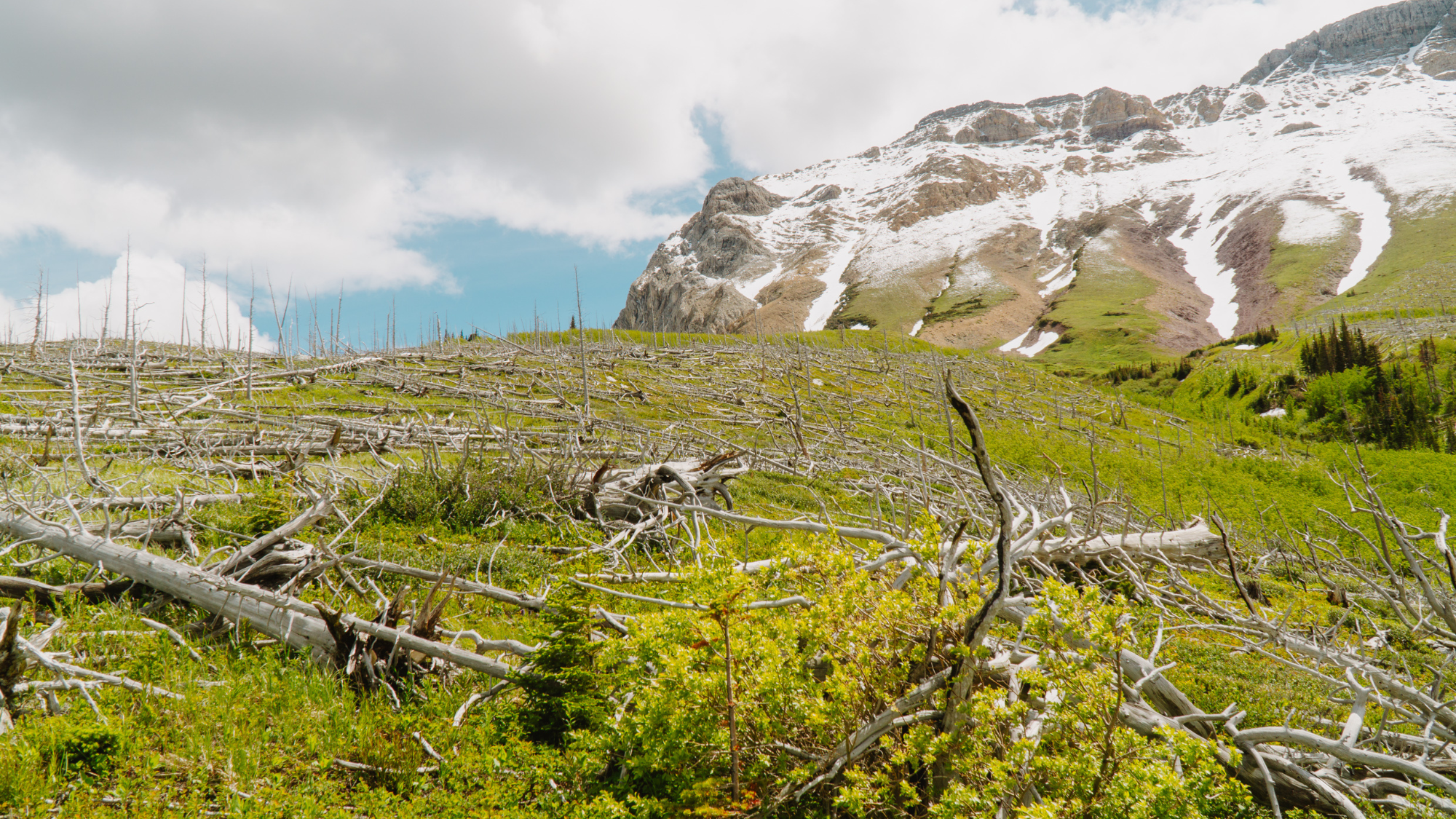
Paysage gravement brûlé où peu d’arbres se régénèrent. Dans certaines régions, les forêts ne se rétablissent pas comme prévu après les feux, soulevant des questions sur l’avenir de ces écosystèmes au cours des prochaines décennies.
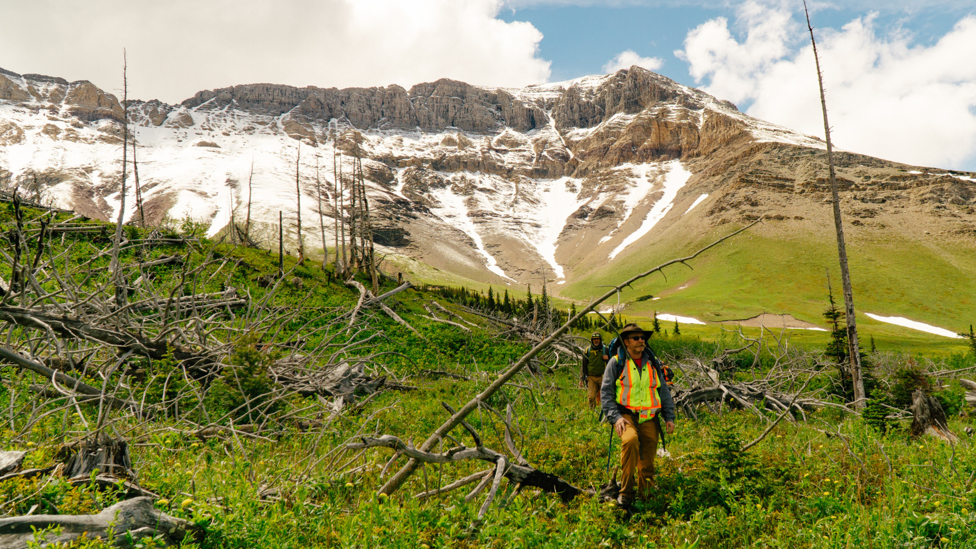
Les chercheurs Sean Parks et Jonathan Coop traversent un paysage brûlé dans le parc national des Lacs-Waterton. L’équipe d’Ellen Whitman a parcouru l’Ouest canadien afin de documenter la façon dont les forêts réagissent à des feux de forêt de plus en plus vastes et sévères.
Vaste secteur gravement brûlé dans le parc national des Lacs-Waterton. Certaines zones sont demeurées forestières, tandis que d’autres ont été presque entièrement détruites par le feu, créant un laboratoire naturel pour étudier la régénération à l’échelle du paysage.
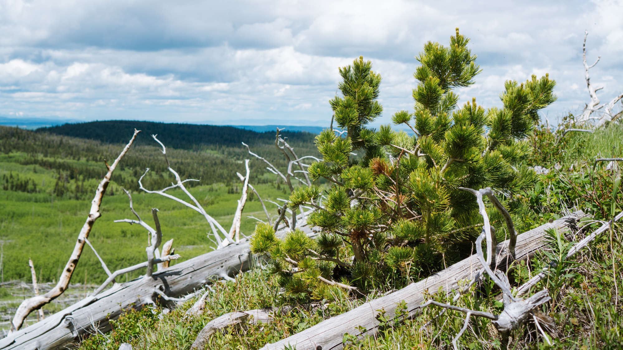
Un jeune pin à écorce blanche pousse parmi des arbres tués par le feu. Même dans les zones les plus sévèrement touchées, de nouvelles forêts peuvent s’établir, mais leur succès dépend de facteurs tels que la disponibilité des graines, le climat et les conditions du site.
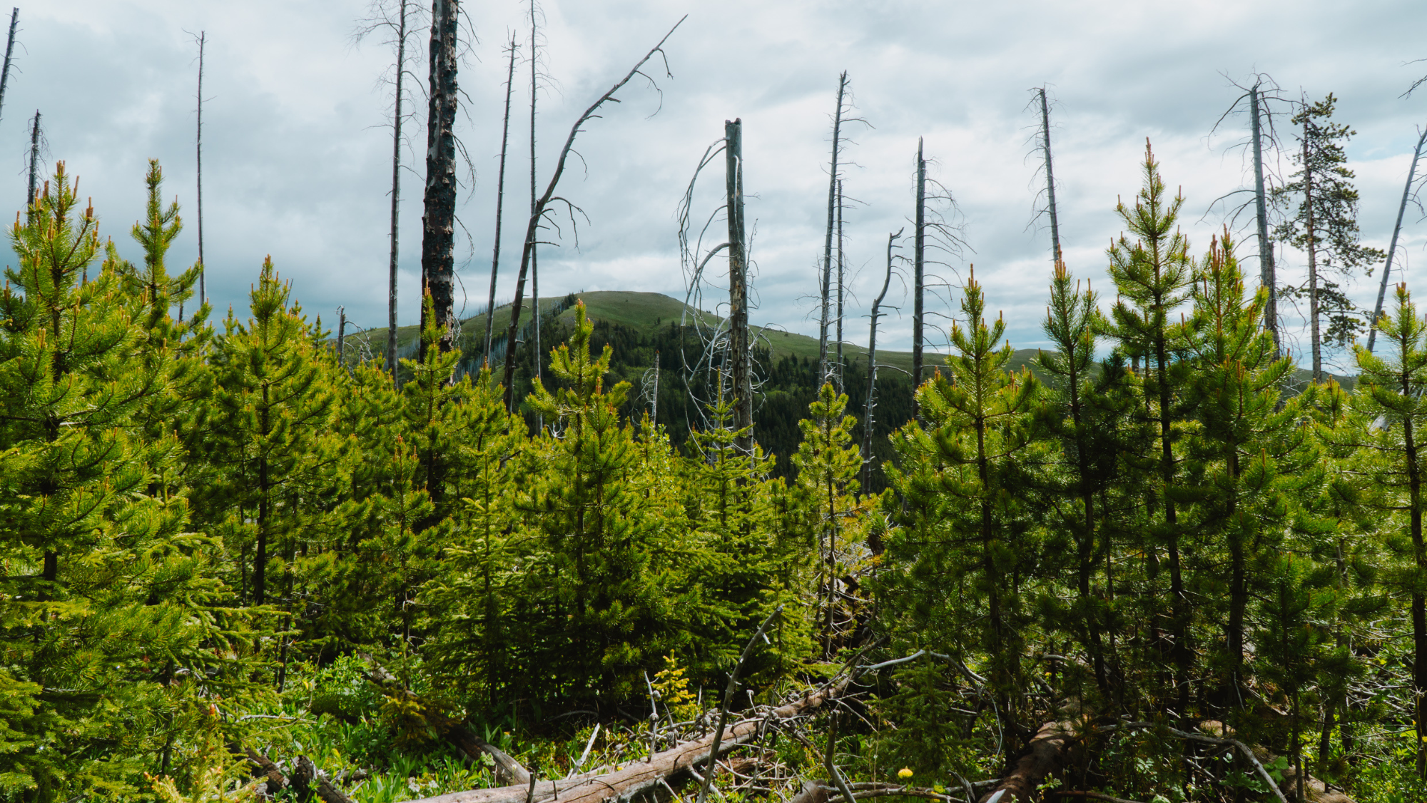
De jeunes pins émergent parmi les arbres morts dans le col Crowsnest. Ces arbres offrent un aperçu de ce à quoi pourrait ressembler la prochaine génération de forêt et aident les chercheurs à comprendre où la régénération a le plus de chances de réussir.
AU-DELÀ DE LA
SUBVENTION TREBEK
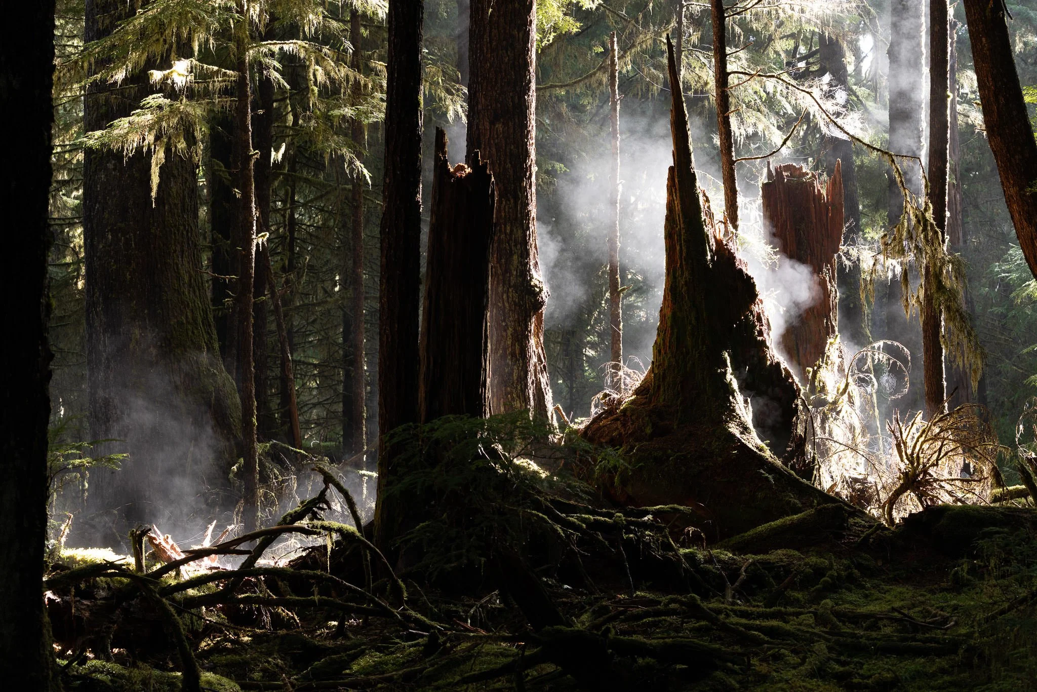
PRÉSERVER LES FORÊTS GRÂCE AUX AIRES PROTÉGÉES.
TJ Watt – Exploring & Documenting Endangered Ancient Forests in BC
Partout en Colombie-Britannique, les efforts visant à préserver les forêts anciennes misent de plus en plus sur des initiatives de conservation dirigées par les Premières Nations et sur la protection à long terme d’écosystèmes entiers.
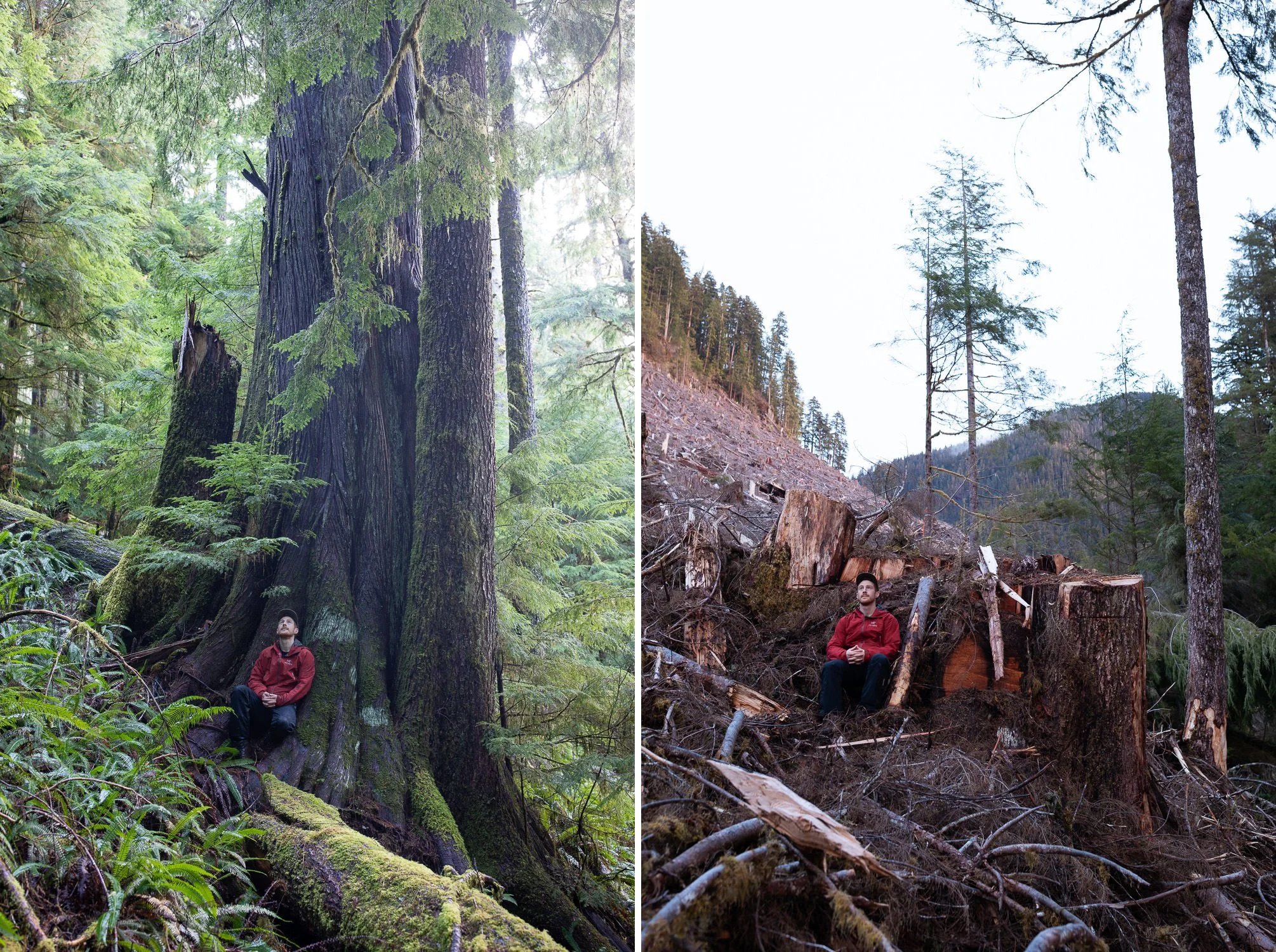
Dans le cadre de son projet soutenu par Trebek, TJ Watt a documenté la disparition de forêts anciennes menacées à l’aide de photographies avant-après, révélant les effets de la coupe à blanc sur des forêts composées d’arbres âgés de 500 à 1 000 ans. En retournant aux mêmes endroits avant et après leur exploitation, ses images ont mis en lumière la destruction de forêts irremplaçables qui se déroule loin du regard du public.
Ce travail a contribué à attirer l’attention sur la disparition des forêts anciennes grâce au rôle de TJ Watt comme cofondateur de l’Ancient Forest Alliance, où ses photographies et son travail de sensibilisation ont joué un rôle important dans l’évolution des politiques de conservation en Colombie-Britannique. Ses explorations ont également permis de découvrir certains des plus grands et des plus remarquables arbres anciens encore présents au Canada.
Dans la continuité de ce travail, TJ participe maintenant aux activités de la Nature-Based Solutions Foundation, qui aide à mobiliser du financement pour la conservation afin de soutenir les Premières Nations dans la création de nouvelles aires protégées et le développement d’économies fondées sur la conservation comme solution de rechange à l’exploitation des forêts anciennes. Bien que son travail de documentation de la beauté et de la destruction des forêts anciennes se poursuive, il contribue désormais aussi à aider des communautés à protéger durablement des milliers d’hectares d’écosystèmes menacés pour les générations futures.
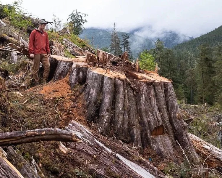
Ce qu’il reste d’une forêt ancienne après sa coupe. Dans la vallée de Caycuse, les images de TJ Watt révèlent des forêts qui mettent des siècles à se développer et quelques jours à disparaître.
Résultats du projet :
Photographies avant-après documentant la perte de forêts anciennes dans des paysages menacés
Couverture médiatique nationale et internationale sensibilisant le public à la disparition
des forêts anciennes menacéesCollaboration avec des Premières Nations et des communautés locales dans le cadre
d’initiatives de conservation à long termeDéveloppement d’un modèle de financement de la conservation soutenant la création
de nouvelles aires protégéesSoutien direct aux aires protégées et de conservation autochtones qui permettront de
protéger plus de 400 km² de forêts anciennes
NOS NOUVEAUX BÉNÉFICIAIRES
Chaque année, Trebek soutient des personnes qui explorent certains des changements
les plus importants au Canada. Découvrez leurs projets dans leurs propres mots.
PRÉSENTATION DES BÉNÉFICIAIRES TREBEK 2026
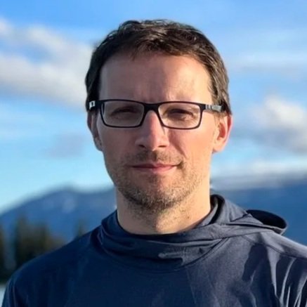
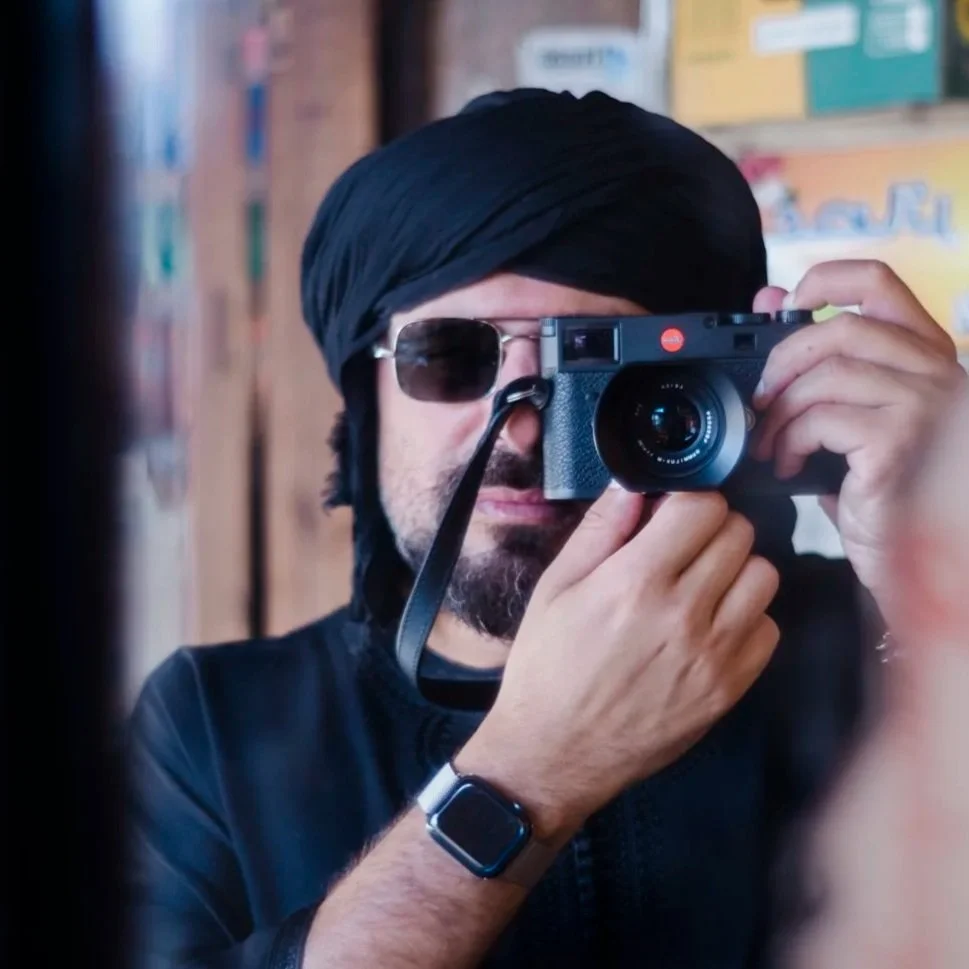
MICHAEL CHRISTOPHER BROWN
Sacred Balance: Climate Change & Co‑Stewardship in the Muskwa‑Kechika
La zone de gestion Muskwa-Kechika, dans le nord de la Colombie-Britannique, est l’une des plus vastes régions sauvages intactes d’Amérique du Nord : six millions d’hectares de montagnes, de rivières et de vallées sans routes, dont les Kaska Dena et d’autres Premières Nations prennent soin depuis des milliers d’années. En son cœur coule la rivière Kechika, un important corridor écologique permettant à des espèces comme l’orignal, le caribou et le grizzli de se déplacer et de s’adapter aux changements climatiques.
Près de vingt ans après avoir photographié cette région pour le National Geographic Magazine, j’y retourne afin d’observer comment le territoire et les communautés qui y vivent réagissent à l’accélération des changements climatiques : hivers plus doux, fonte du pergélisol et modification des déplacements de la faune. En collaboration avec les gardiens du territoire kaska dena, les Aînés et les jeunes, notre projet, Sacred Balance, combinera savoirs traditionnels et science afin de raconter ces transformations à travers l’image, le son et la cartographie.
Ensemble, nous créerons un témoignage visuel de ces changements grâce à la photographie comparative, à la captation vidéo et sonore, ainsi qu’à une carte narrative interactive (StoryMap) réunissant cartes, récits et voix du bassin de la Kechika. Présenté d’abord dans les communautés kaska dena, le projet montrera comment l’intendance des Premières Nations et la résilience écologique se rejoignent dans l’une des dernières grandes régions sauvages intactes de la planète.
DR. EDWIN NISSEN
A new source of earthquakes and tsunamis shaping Vancouver Island’s iconic west coast
La côte ouest de l’île de Vancouver est l’un des paysages les plus emblématiques du Canada, mais aussi l’une de ses régions les plus exposées aux séismes et aux tsunamis. Elle correspond aux quelque 300 kilomètres les plus au nord de la zone de subduction de Cascadia, longue d’environ 1 000 kilomètres, où la plaque océanique Juan de Fuca s’enfonce sous la plaque nord-américaine le long d’une faille de chevauchement à faible pendage dont la trace se situe à environ 100 kilomètres au large.
Actuellement verrouillée, la faille accumule progressivement des contraintes tectoniques qui seront libérées lors du prochain grand séisme de Cascadia et du tsunami qui l’accompagnera. Toutefois, comme le dernier événement de ce type remonte à l’an 1700, bien avant les observations modernes, la nature exacte du prochain demeure incertaine. Un indice important provient de notre découverte inattendue d’une rupture de surface sur l’île Flores, située dans le haḥuułi (territoire traditionnel) de la Première Nation ʕaaḥuusʔatḥ (Ahousaht), dans le secteur de Clayoquot Sound, en Colombie-Britannique. Nous émettons l’hypothèse que cette faille, située dans la partie supérieure de la plaque nord-américaine et première structure de ce type identifiée dans l’ensemble de la zone de subduction de Cascadia, a été générée par un séisme de subduction exceptionnellement puissant au large, possiblement celui de l’an 1700. Nous mettrons cette hypothèse à l’épreuve en déterminant l’âge de la rupture à l’aide de travaux d’échantillonnage sur le terrain et de diverses techniques de datation, puis en comparant les résultats à la chronologie connue des grands séismes de subduction.
Le projet permettra de mieux comprendre un scénario catastrophe de séisme et de tsunami en Cascadia, tout en contribuant à améliorer les systèmes d’alerte précoce, les mesures d’évacuation et notre compréhension des forces tectoniques qui façonnent la côte pacifique du Canada.
VALERIA VERGARA
Listening to whales: using hydrophones, drones, and AI to unravel killer whale communication dynamics
Les épaulards vivent au sein de sociétés étroitement liées par le son. Chez les épaulards résidents du Nord, chaque groupe possède son propre dialecte, transmis de génération en génération, un remarquable exemple de culture non humaine. Pourtant, malgré des décennies de recherche, nous ignorons encore la signification de la plupart de ces vocalisations et la façon dont ils les utilisent dans leur vie sociale complexe.
Ce projet réunit des biologistes marins et des spécialistes de l’intelligence artificielle afin d’étudier la communication des épaulards selon une approche intégrée. À l’aide d’enregistrements sous-marins synchronisés, d’images captées par drone et de l’apprentissage automatique, nous cherchons à relier certaines vocalisations aux comportements, aux rôles sociaux et aux contextes dans lesquels elles sont produites. Nous voulons également mieux comprendre comment le bruit d’origine humaine dans l’océan perturbe ces interactions essentielles. En étudiant à la fois les épaulards résidents du Nord, qui se nourrissent de poissons, et les épaulards de Bigg, qui se nourrissent de mammifères marins, nous pouvons comparer l’évolution des stratégies de communication entre des écotypes aux régimes alimentaires, aux structures sociales et aux comportements vocaux distincts.
Un projet pilote mené avec succès en 2025 a démontré la faisabilité de cette approche dans les conditions de terrain de la côte nord-est de l’île de Vancouver. La prochaine phase élargira ce travail et jettera les bases d’un cadre commun pour l’étude de la communication des épaulards à travers différentes populations, en lien avec un projet parallèle prévu en Islande. En écoutant attentivement ces baleines, nous approfondirons notre compréhension de leur richesse culturelle et contribuerons à l’élaboration de stratégies visant à améliorer la qualité de leur environnement acoustique.
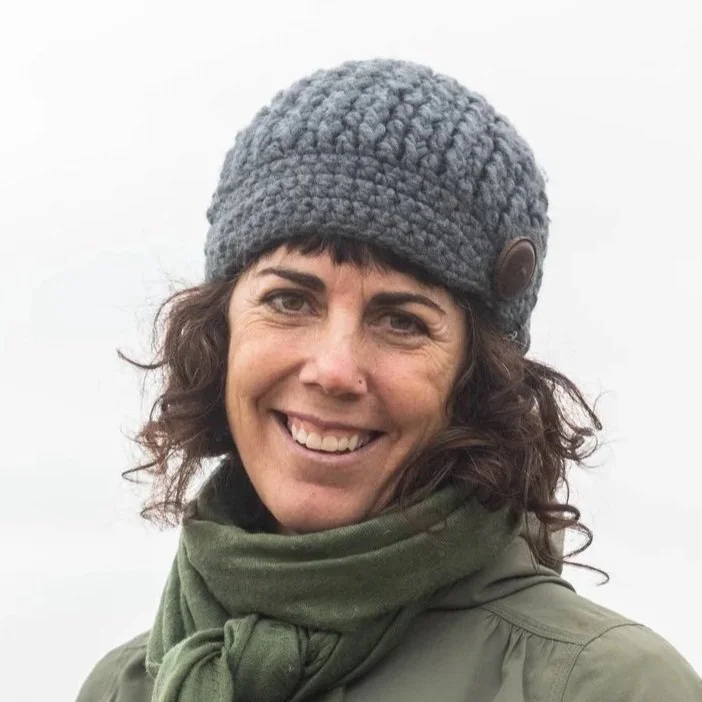
RAQUEL ALFARO SANCHEZ
Tracking Climate-Driven Shifts in Canada’s Latitudinal Treeline
La transition entre la forêt boréale et la toundra dans le nord du Canada, où le couvert forestier devient clairsemé et fragmenté, marque une frontière écologique sensible où de faibles variations climatiques peuvent entraîner d’importants changements du paysage. Pourtant, en raison de son isolement, cette zone de transition forestière demeure l’une des régions les moins étudiées du pays.
Grâce au soutien de l’Initiative Trebek, Raquel parcourra la rivière Coppermine au Nunavut afin d’explorer 469 km² de la zone de transition forestière du nord canadien. Son projet examinera comment les principales espèces d’arbres et d’arbustes réagissent au réchauffement rapide du climat et déterminera si la forêt boréale progresse au-delà de ses limites actuelles. Cette expédition fournira des observations essentielles sur la façon dont les changements climatiques transforment les écosystèmes du Nord canadien.
MONICA TAIS ENGEL
Water Bears and People on Canada’s Eastern Edge
Les habitants des côtes de Terre-Neuve-et-Labrador observent de plus en plus souvent des ours polaires circuler dans leurs cours, entrer dans des chalets, s’aventurer dans des spas extérieurs et créer des situations à risque pour les ours comme pour les animaux de compagnie. La glace fond plus rapidement et les ours de la sous-population du détroit de Davis passent davantage de temps sur la terre ferme. Leurs routes migratoires traversent également des zones côtières habitées, de sorte que les rencontres avec les humains sont inévitables. Cette situation soulève des enjeux pour les ours, les résidents côtiers, les gestionnaires de la faune et les décideurs. Coexister avec les ours polaires prend plusieurs formes, mais sans une meilleure compréhension de ce qui se passe dans la région, sans cartographier ces interactions et sans tirer des leçons des rencontres passées, il subsistera toujours des angles morts dans la prise de décision, et les conflits risquent de s’intensifier en l’absence de mesures préventives.
Mon projet est unique, car il sera le premier à documenter et à cartographier les interactions entre les humains et les ours polaires dans la région. Il combinera des données tirées des médias historiques et actuels, ainsi que des entrevues avec des personnes ayant rencontré des ours et avec celles chargées de gérer ces interactions. En collaboration avec les résidents locaux, nous installerons des caméras de suivi sur une petite île située à seulement 15 kilomètres de la côte de Terre-Neuve afin de vérifier l’existence d’un site de mise bas soupçonné depuis longtemps, mais jamais documenté. Une telle découverte améliorerait considérablement notre compréhension des habitats maternels essentiels dans le détroit de Davis et démontrerait une fois de plus l’importance d’écouter les communautés et de travailler ensemble.
Grâce à une forte composante de récit, nous réaliserons un documentaire et installerons d’autres caméras de suivi près des communautés afin de documenter la présence des ours le long de leurs routes migratoires terrestres. Ce projet offre également une occasion unique d’explorer le moment où la tolérance envers les ours polaires s’effrite et où les interactions deviennent une source de conflit pour les gestionnaires, les communautés et les décideurs. Il s’agit avant tout de mieux comprendre ce que signifie coexister avec les ours polaires.
M’HAMMED KILITO
Confluences: A Human and Aquatic Cartography of the Laurentian System
Confluences est une expédition photographique qui suit le parcours de 3 700 kilomètres du fleuve Saint-Laurent, du lac Ontario jusqu’à l’océan Atlantique. Réalisé en collaboration avec les communautés locales, le projet raconte l’histoire des personnes qui vivent le long du fleuve et explore la relation qu’elles entretiennent avec lui. Le long de ses rives, je photographierai la vie de ses villes, les traces laissées par ses industries et la résilience des communautés riveraines. Plus grand fleuve du Canada, le Saint-Laurent se trouve aujourd’hui à un tournant, confronté aux pressions combinées de l’industrie, des changements climatiques et de la pollution.
Le voyage débutera à Kingston, là où le fleuve prend naissance à partir du lac Ontario, puis se poursuivra à Cornwall, Montréal, Trois-Rivières, Québec, dans la péninsule gaspésienne, à Tadoussac et à Havre-Saint-Pierre, jusqu’à la communauté innue d’Ekuanitshit, où les résidents vivent directement les transformations écologiques et témoignent des changements qu’ils observent. Il se terminera sur la Basse-Côte-Nord et aux Îles-de-la-Madeleine, où l’érosion côtière et la montée des eaux menacent les modes de vie locaux.
En chemin, je rencontrerai des personnes de tous horizons, notamment des travailleurs, des agriculteurs, des scientifiques, des artistes et des pêcheurs, dont les expériences révèlent à quel point nos vies sont liées au fleuve et aux paysages qui nous font vivre.
PRIX ET DISTINCTIONS DES BÉNÉFICIAIRES
2022 TREBEK GRANTEE | YVONNE DREBERT | GREAT LAKES EXPLORATION
Yvonne Drebert a été nommée lauréate du Prix Wayfinder 2026 de National Geographic, une distinction qui souligne le travail de personnes dont les contributions font progresser l’exploration, la science, la conservation et le récit.
Cinéaste et exploratrice sous-marine, Yvonne utilise des drones sous-marins de pointe pour révéler des environnements d’eau douce rarement observés. Son travail applique aux Grands Lacs des techniques d’exploration habituellement utilisées en milieu océanique, documentant des paysages et des écosystèmes submergés tout en élargissant notre compréhension des milieux d’eau douce.
Remis par la National Geographic Society, le Prix Wayfinder célèbre une cohorte mondiale d’acteurs du changement dont le travail contribue à façonner un avenir plus durable et une meilleure compréhension du monde qui nous entoure.
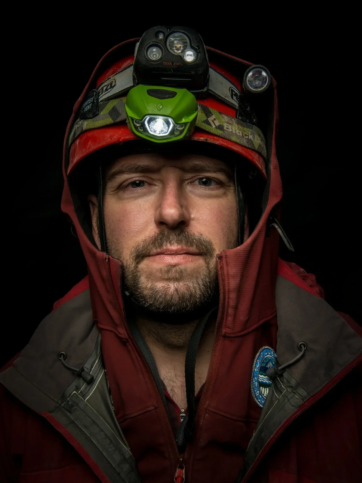
2021 TREBEK GRANTEE | CHRISTIAN STENNER | GLACIOVOLCANIC CAVES
Christian Stenner figure dans le National Geographic Learning Launchpad, une nouvelle expérience éducative présentée au National Geographic Museum of Exploration à Washington, D.C.
Cette exposition interactive s’appuie sur le travail des Explorateurs de National Geographic pour initier les élèves à la pensée géographique et à l’esprit d’exploration. L’exploration des grottes glaciovolcaniques par Christian y est mise en valeur, permettant aux visiteurs de découvrir l’un des environnements les plus singuliers et les moins connus du Canada.
Le Learning Launchpad sera découvert par des milliers de visiteurs chaque année, reliant les jeunes à l’exploration, à la science et à la découverte à travers des exemples concrets issus du terrain.
2021 TREBEK GRANTEE | SARA HYLTON | WE HAD ALL KINDS OF WATER
Sara Hylton a reçu le Prix d’argent dans la catégorie Essai photographique et photojournalisme aux Prix du magazine canadien pour les photographies qui accompagnaient le reportage de Brandi Morin publié dans Canadian Geographic, We Had All Kinds of Water.
À l’aide d’un appareil moyen format argentique, Sara a documenté la vie à Neskantaga First Nation alors que la communauté vivait sous le plus long avis d’ébullition de l’eau de l’histoire du Canada. Ses images accompagnaient le reportage de Morin, offrant un puissant témoignage visuel d’une communauté confrontée aux défis et aux conséquences de plus de trois décennies sans accès à une eau potable salubre.
Ce prix souligne une collaboration alliant reportage approfondi et photographie pour raconter une histoire d’importance nationale. Lire l’article
2024 TREBEK GRANTEE | ISABELLE GROC | SHOREBIRDS: SENTINELS OF THE MUDFLATS
Isabelle Groc a reçu le Prix d’argent dans la catégorie Science et technologie lors de la 11e édition des Digital Publishing Awards pour son reportage multimédia publié dans Canadian Geographic, The Magic in the Mud.
Combinant reportage et photographie de conservation, cette histoire explore le rôle essentiel du biofilm dans l’alimentation du bécasseau d’Alaska au cours de sa migration de 10 000 kilomètres le long de la voie migratoire du Pacifique. En mettant en lumière cette source de nourriture souvent méconnue présente dans les vasières de Roberts Bank, Isabelle attire l’attention sur l’importance écologique de l’un des plus importants sites de halte migratoire au Canada.
Cette reconnaissance s’ajoute à une liste grandissante de distinctions pour ce projet, dont un prix international AAAS Kavli en journalisme scientifique. Son documentaire Sandpipers' Last Supper a également reçu quatre nominations aux LEO Awards, notamment dans les catégories Meilleure réalisation et Meilleur scénario. Lire l’article
ÉVÉNEMENTS À VENIR
Grâce à un nouveau partenariat avec Exploring By The Seat Of Your Pants, les bénéficiaires Trebek partagent leurs expériences de terrain avec des jeunes lors de rencontres virtuelles en direct. Créée par l’explorateur de National Geographic Joe Grabowski, la plateforme a rejoint plus de 1,5 million de jeunes dans plus de 113 pays.
Les premières séances Trebek ont eu lieu ce printemps, mettant les participants en contact avec des bénéficiaires qui mènent leurs projets partout au Canada. D’autres événements seront proposés à l’automne, avec le retour en classe. D’ici là, vous pouvez visionner les enregistrements de deux présentations récentes ci-dessous.
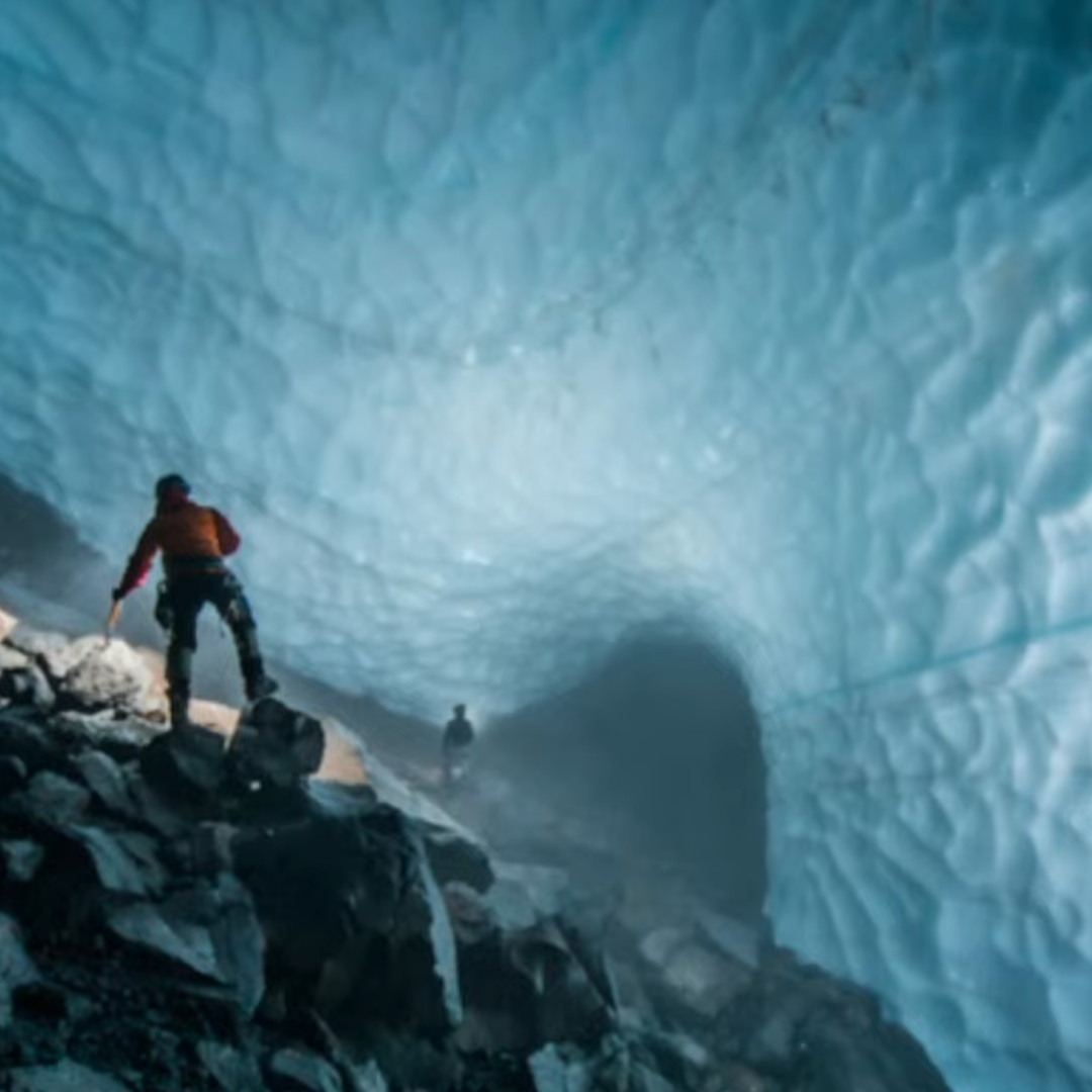
Wild Caving with Christian Stenner
Explorez certains des endroits les plus sombres et les plus fascinants de la planète : des grottes formées par l’interaction entre la glace glaciaire et la chaleur volcanique, créant des environnements uniques où le froid et la chaleur coexistent. Christian Stenner a exploré les plus vastes et les plus profondes grottes glaciovolcaniques du monde. Ces grottes nous renseignent sur l’activité volcanique, l’évolution du climat, les microorganismes capables d’y survivre dans des conditions extrêmes et la façon dont nous pourrions un jour découvrir la vie sur d’autres planètes.
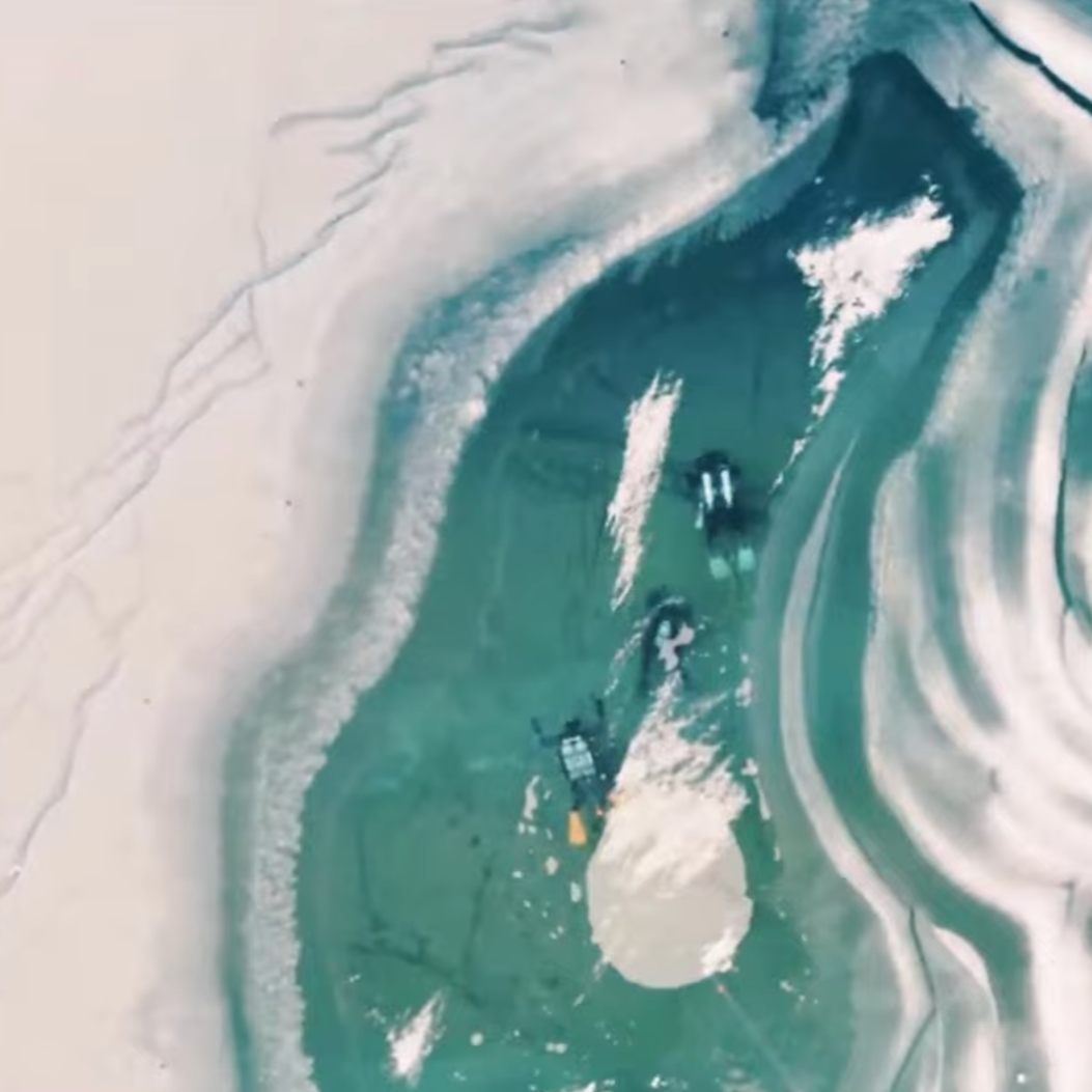
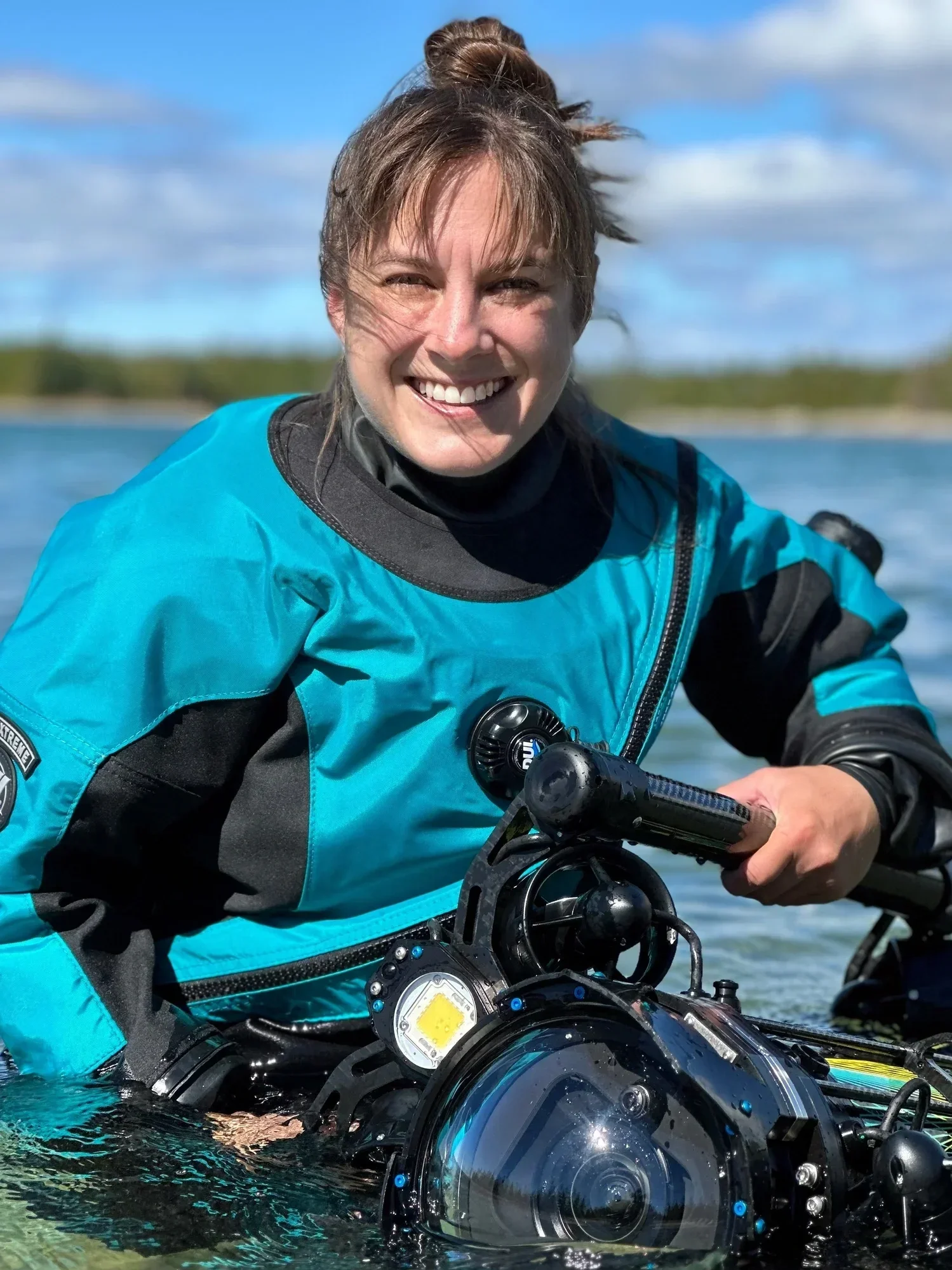
Freeze the Future – Exploring Frozen Lakes with Andrew Budziak
Explorez un monde caché sous la glace. L’explorateur, cinéaste et photographe de nature canadien Andrew Budziak dirige Freeze The Future, un projet qui mène des plongeurs sous des lacs gelés afin d’étudier des algues microscopiques et de mieux comprendre les effets des changements climatiques sur les écosystèmes d’eau douce. À travers le film, la science et l’exploration, Andrew montre que certaines des découvertes les plus importantes se trouvent parfois beaucoup plus près de nous qu’on ne l’imagine.

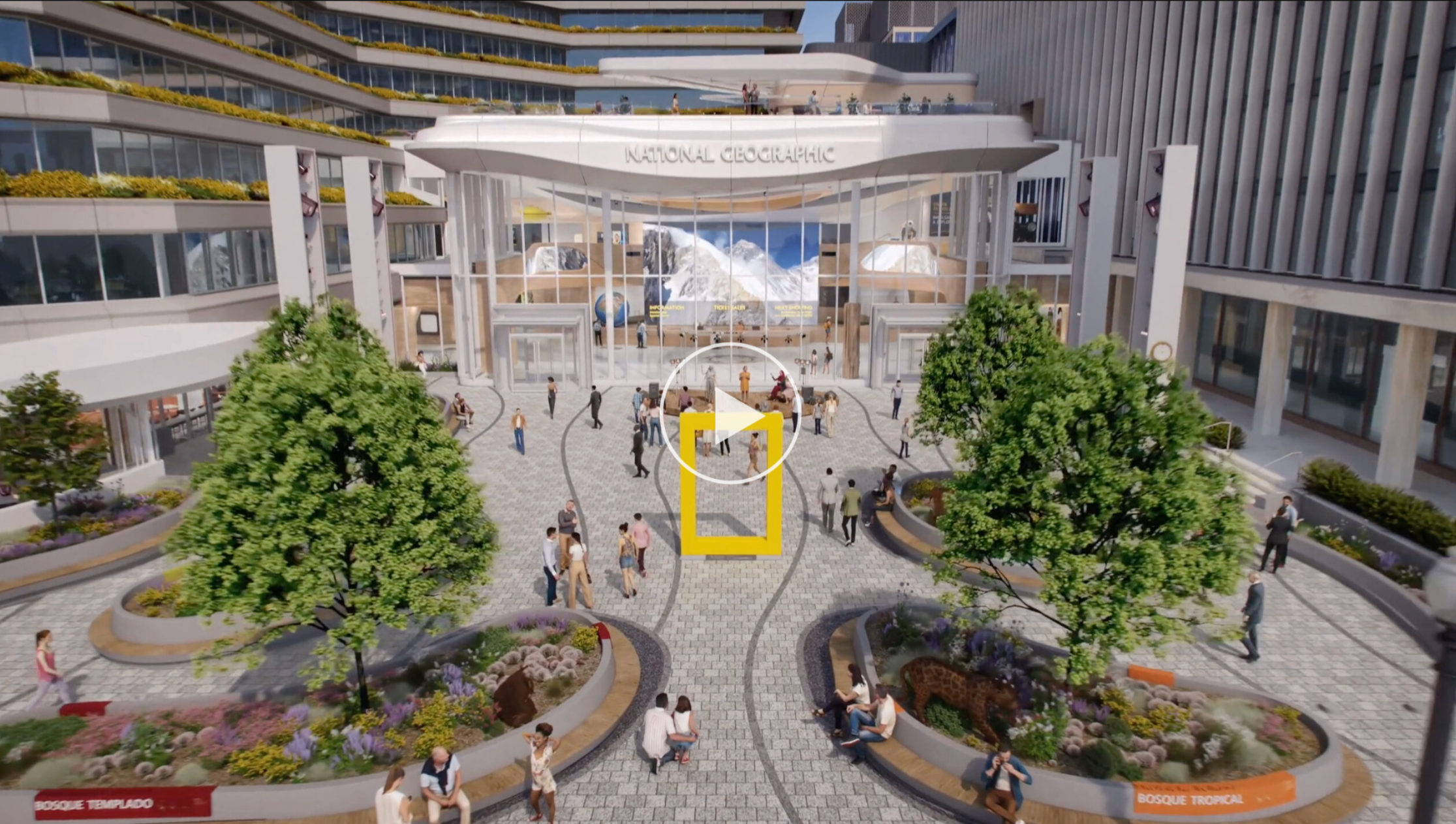
BIENVENUE À BASE CAMP DE NATIONAL GEOGRAPHIC
Depuis plus d’un siècle, National Geographic poursuit une mission : faire découvrir les merveilles de notre monde et contribuer à leur préservation. Cet été marque un nouveau chapitre avec l’ouverture de Base Camp, un campus réinventé à Washington, D.C., conçu pour donner vie à cette mission par l’exploration, le récit, l’éducation et l’engagement du public.
Conçu comme un lieu où les explorateurs peuvent partager leurs découvertes et échanger avec le public, Base Camp proposera des expositions, des récits et des occasions de collaboration. En réunissant explorateurs, jeunes et acteurs du changement, ce nouveau campus vise à éveiller la curiosité, à offrir une meilleure compréhension du monde qui nous entoure et à contribuer à éclairer la voie vers un avenir plus durable.
Visionnez la vidéo ci-dessous pour découvrir ce nouvel espace.

GEOGRAPHICA 2026
La plus importante collecte de fonds annuelle au Canada au profit de l’exploration et de l’éducation géographique sera de retour à Ottawa le 4 novembre 2026.
Cette année, Geographica : Voyage vers les étoiles célébrera la contribution du Canada à l’exploration spatiale à travers une soirée de récits, de photographie, de cinéma, de gastronomie et d’échanges. Réunissant astronautes, explorateurs, chercheurs, éducateurs et philanthropes, l’événement mettra en lumière celles et ceux qui contribuent à élargir notre compréhension du monde et de l’espace.
Les fonds recueillis soutiennent les programmes d’exploration, d’éducation et de recherche de la Société géographique royale du Canada.
Suivez-nous sur Instagram @trebekinitiative
MERCI
Votre engagement soutient les efforts des bénéficiaires de l’Initiative Trebek pour générer un impact concret partout au Canada, qu’il s’agisse de mieux comprendre des enjeux urgents, de préserver le patrimoine culturel ou d’inspirer la prochaine génération de scientifiques, de conteurs et d’éducateurs.
Ensemble, nous contribuons à susciter une passion pour la préservation partout au Canada.
